MOUNT WHITNEY DANGER ZONES
Where, why and how injuries and fatalities occur on the highest mountain in California.
...and how to mitigate the contributing hazards.
_________________________________________________________________________________________
This is the extended version of the article that I wrote for The American Alpine Club that appears in the 2026 edition of Accidents in North American Climbing. You can read that article here.
All photos by the author.
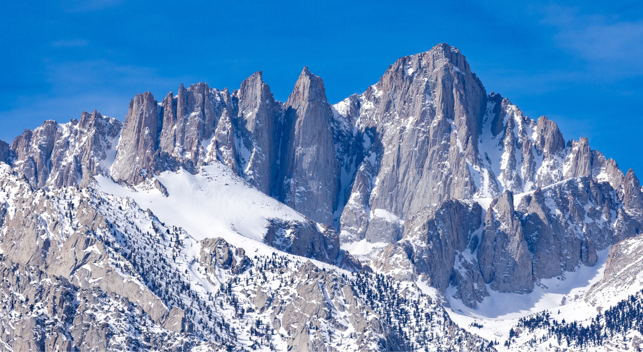
May 24th, 2023
I sat alone on the summit blocks, staring down into ten thousand vertical feet of crisp, cold air between my ski boots and Owens Valley. It was a perfect day: no wind, bluebird. A reporter from the LA Times and the guide he'd climbed the Mountaineers Route with had just left to start their descent, but before they did, we'd all chatted about the record Winter. It was the end of May, and the Sierra was still completely inundated with snow. They were the only people I'd seen on the mountain that day, rare in May for Mount Whitney. People who'd won early season permits in the 2023 lottery quota season were canceling them, unprepared for the conditions. It was an anomaly that had allowed me to be sitting at 14,505 in ski boots at the end of Spring, and I was grateful for the opportunity. I was more grateful that early-season Mount Whitney aspirants were collectively tapping the brakes on an outlier scenario. I ripped skins, stepped into my bindings, and skied southwest off the summit, the start of a seven thousand vertical foot descent back to my car.
Five months later, an Air France pilot would fall to his death down the North Face of Mount Whitney.
It had happened many times before, and it would happen again…
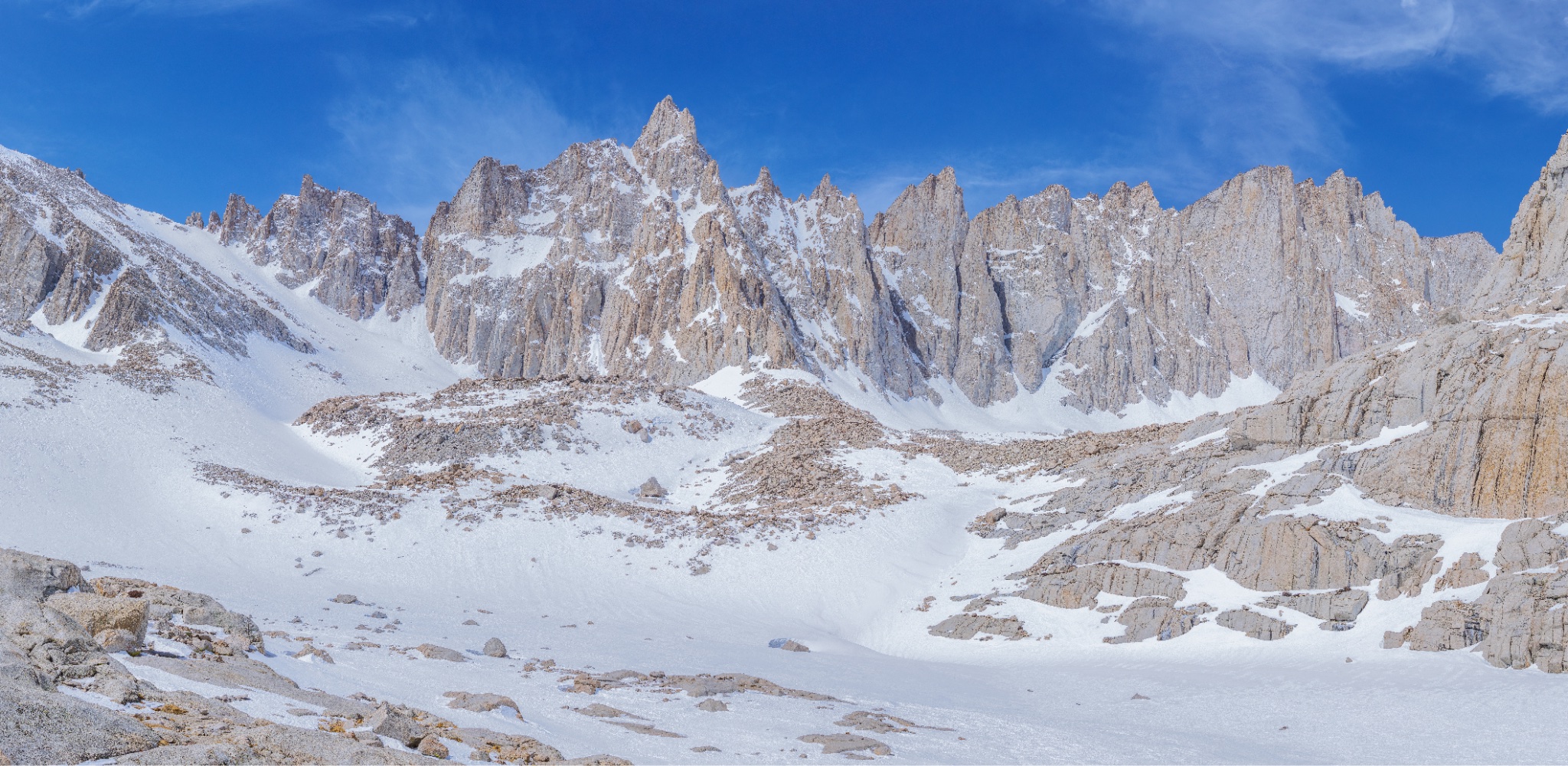
Whitney is known for being a hike, and it usually is one. That perception drives a lot of traffic to its trails and slopes, but it's a big mountain that frequently straddles the line between hiking and mountaineering. When the perception that it's a hike and the reality that it's not collide, people are sometimes injured or killed. The line of demarcation between hiking and mountaineering is often not well-understood by those who most frequently suffer the consequences of crossing it unknowingly.
This is a prominent and recurring theme on Mount Whitney. Why?
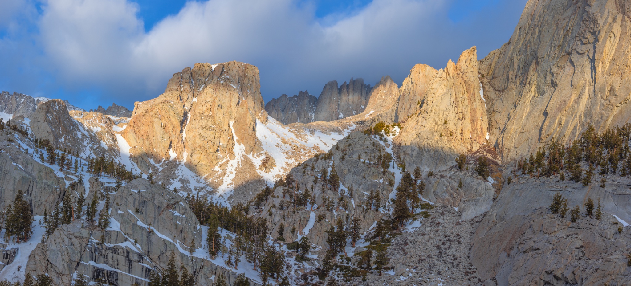
April 17th, 2022
"To the summit!", they said in unison.
I'd asked them where they were headed. I was doing a gear transition at 10,700 feet, from trail-running mode into mountaineering mode. They approached me near a small stream flowing out of Mirror Lake. The trail had been dirt up until now. It was mid-April, and Whitney was snowed in from here up. The Sun was climbing over a windy horizon, across Owens Valley and above the ragged silhouette of the Inyo Range. It was cold. They asked me the same question. "Oh…" I pointed absently; it was something I'd been planning for weeks. "Up that couloir. Not the standard route - do you have crampons? Axes? Helmets?" I asked, noticing they didn't, but wanting a reason to start the conversation. "I read on the internet that you don't need those for Whitney." The answer I'd expected, and one I'd heard before. "You don't...always," I replied. "But you do, now."
They nodded, shrugged, and we parted ways.
Later that evening, I was shivering at 12,600 feet, helping to coordinate a rescue with InyoSAR; someone had attempted the 99 Switchbacks, a bad route choice considering the conditions, with none of the required gear. I assisted when asked, then descended late into the night, exhausted.
The next day, a hiker would attempt the same thing in the same place and fall to his death.
It wasn't the first time it had happened. It wouldn't be the last...
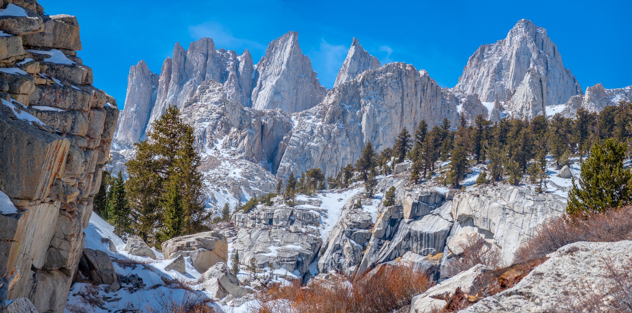
Why has Mount Whitney proven to be as deadly as it has been?
Because of what it is, and where it is, Mount Whitney is unique in many respects. It's the highest mountain in the Lower 48. The range in which it lies is wedged between extremes: the Pacific Ocean to the west, multiple rain shadows and Death Valley to the east. The Sierra Nevada rises up dramatically out of a desert on its eastern terminus. Extensive trail networks sprawl over high passes and through beautiful alpine valleys streaked with streams and dotted with thousands of shining lakes and tarns, remnants of the Tioga Glacial Maxima. It's an amazing place, and Mount Whitney is the centerpiece: a highly sought-after alpine crown jewel on the Eastern Escarpment, towering above the valley below and beckoning.
A large portion of the injuries and deaths we see on Mount Whitney are frequently the result of people who don't make the transition between low-consequence hiking and higher-consequence classic mountaineering, either because they didn't recognize the line of demarcation between the two, they underestimated the various threats that existed and had inappropriate (or no) mitigation strategies in place, or they just didn't realize that any of it applied to their current situation, until it did.
People who’ve never been on Mount Whitney (or have been, but only in perfect, dry conditions) may balk at the word “mountaineering” being used as a verb to describe how Whitney is approached. Indeed, that is a large part of the problem. So some definitions are in order.
Hiking is just that: walking up a trail. Mountain trail-running is, well, trail-running in the mountains. Classic mountaineering can be (and usually is) defined as the process of ascending, traversing, descending and otherwise traveling in alpine terrain characterized by steep snow slopes with the use of basic equipment (crampons on mountaineering boots, an ice ax and a helmet). Classic mountaineering may contain some basic rope work, but usually it does not. It’s a simplistic form of mountaineering, and that’s part of its appeal. Technical mountaineering is (you guessed it): technical. (Think multi-pitch alpine/trad climbing, complex rappels, glacier travel and crevasse rescue, ice climbing, mixed climbing, ski mountaineering, etc.). While all of the above modes of travel are used on Mount Whitney, hiking is by far the most common.
Any route on Mount Whitney under Winter or Winter-adjacent conditions (including Spring shoulder season) falls squarely within classic mountaineering territory. Some routes can qualify as technical mountaineering (you can usually make things as difficult as you so desire…)
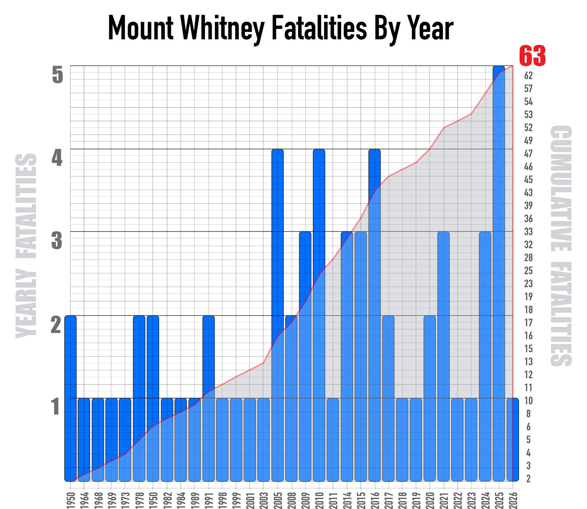
What are the Primary Contributing Factors to Injuries and Fatalities on Mount Whitney?
1.) Hikers in Mountaineering Terrain
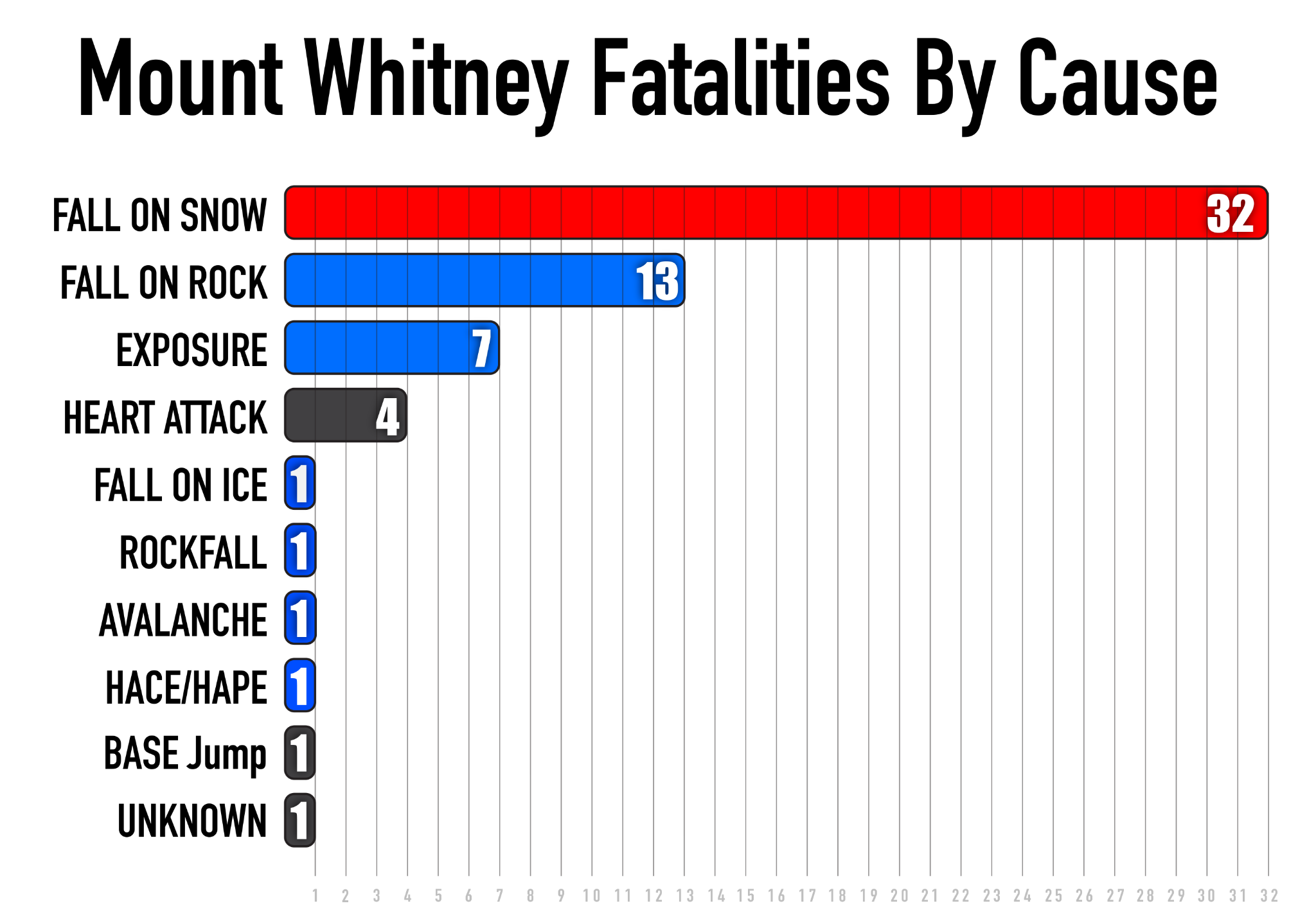
Spring and Fall shoulder seasons represent a heightened incident window on Whitney. Hazards unique to but common in alpine terrain are often not well understood within the hiker community. Why would they be? Those hazards are usually unintuitive. Hiking does not typically involve travel in high alpine terrain characterized by steep, snow-covered slopes at 14 thousand feet. Only about 4% of mountainous terrain in the continental United States qualifies as “alpine terrain,” so it’s a rarefied environment. Travel in this kind of terrain and all that it entails falls well outside of most people's objective reality and ability to adequately envision. Many of these people become hikers-in-mountaineering terrain, only abstractly aware of hazards that need targeted decision-making to avoid. The majority of the fatalities on Mount Whitney have been the consequences of unarrested falls on snow, due in large part to a mismatch of equipment usage and technique to terrain and conditions.
2.) The Permit Pressure Metric
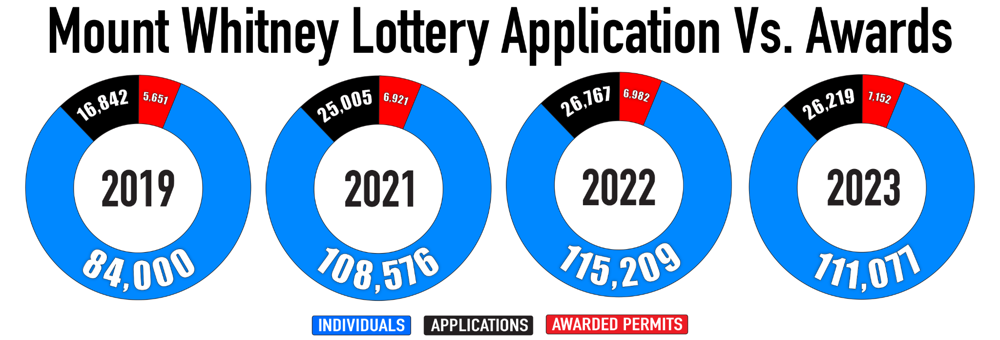
Being inside the Whitney Zone requires a permit, year-round. The quota season is May 1st through November 1st. Most of the people who participate in the permit lottery don't win one. In 2022, 115 thousand people in 27 thousand groups applied. 6,982 permits were issued. As part of the application process, Mount Whitney hopefuls usually enter multiple dates or date ranges for their permit to increase their odds. Once a permit is assigned, its date cannot be altered. Dates specifically requested are not always awarded; the process is random. The permitting system is not the primary cause of the incidents that occur on Mount Whitney, but it's a contributing factor.
A permit that took years to attain is not easily forfeited. Attempts are often made with early season permits (May 1st - mid-June) regardless of current conditions on the mountain.
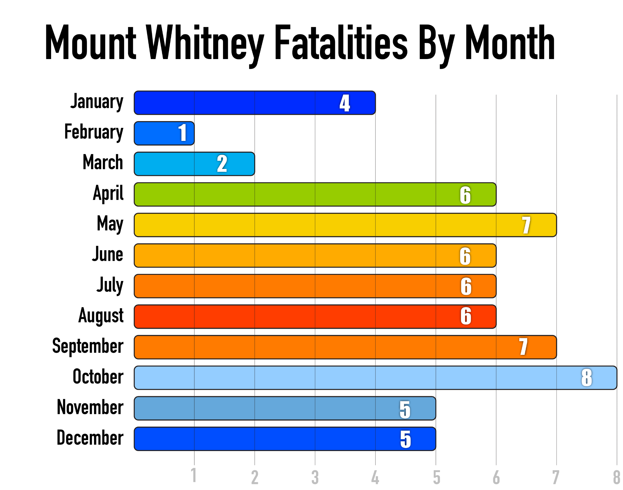
The "I may never get another chance" mindset plays a significant role. Awards are announced in March. People who did not receive a permit sometimes attempt a Whitney ascent before the permit quota begins: a Spring shoulder season attempt in a wide variety of possible conditions, but which usually fall outside of the hiking ecosystem.
3.) Truncated Timelines
Most people who attempt Mount Whitney are hikers, drawn to its aura as a challenging Class 1 ascent to the highest point in America outside of Alaska. They typically choose the John Muir Trail, known locally as the "Main Trail", or less commonly, they attempt the Mountaineers Route. In recent years, day-hikes have become increasingly popular. The Main Trail is about 22 miles and 6,500 vertical feet of gain/loss (out-and-back). The Mountaineers Route is about 8.5 miles with a similar amount of gain/loss (out-and-back), a mix of steep trail and some high-consequence exposed scrambling during Summer conditions. These are manageable numbers for day-hikes in dry terrain when weather and route conditions cooperate, and when fitness level and terrain familiarity align with the itinerary. Most of these hikers have never been to 14,500 feet (very few people have), have little experience with alpine terrain, elevation and acclimatization, and will suffer from some degree of AMS due to truncated ascent schedules on day-hike permits. AMS, inclement weather, difficult conditions, compressed schedules and fitness misalignments to the targeted goal are a combination that frequently leads to negative outcomes.
Where Do Most of the Fatality Incidents on Mount Whitney Occur?
The Traverse and The Final 400
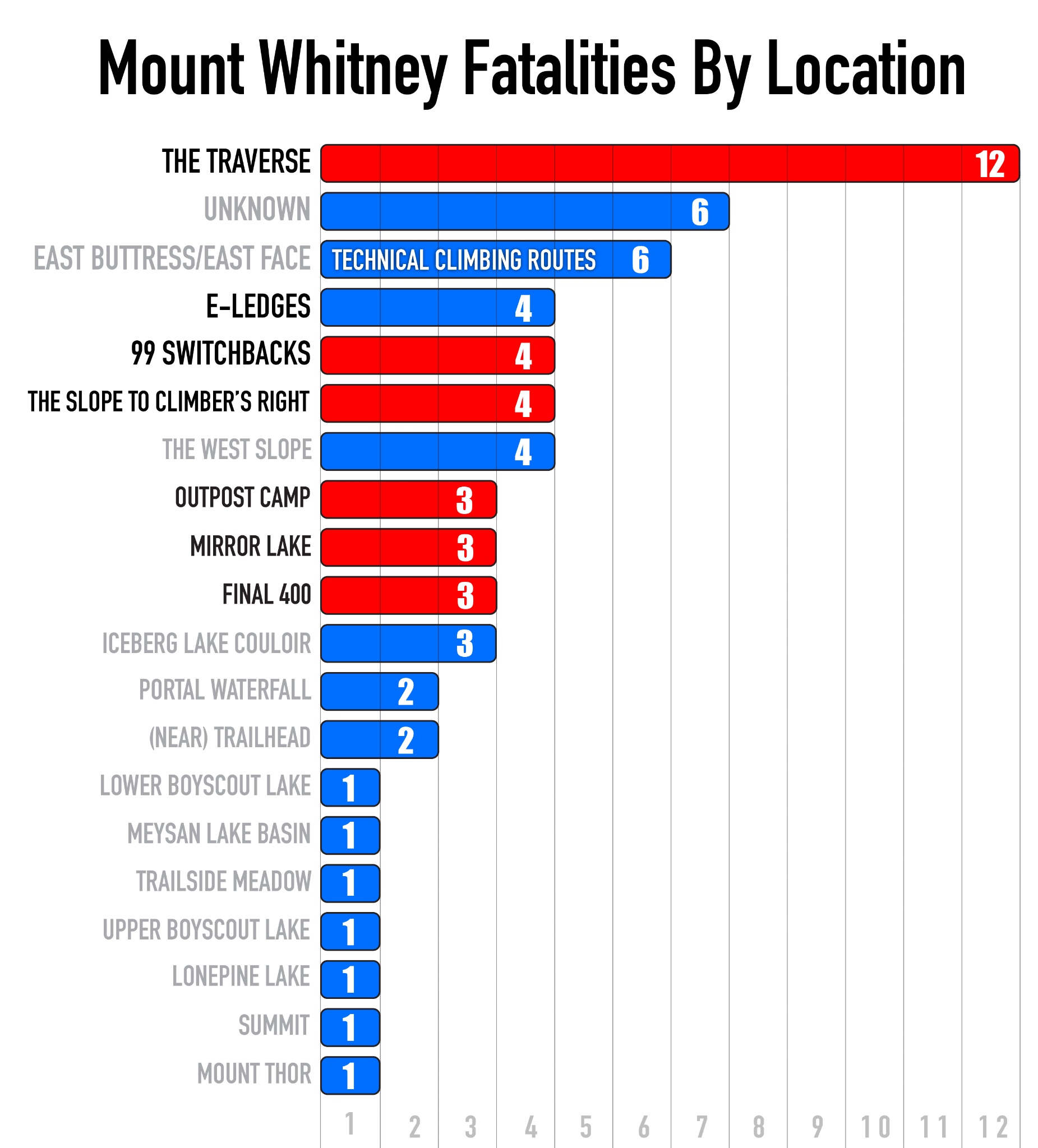
The Mountaineers Route | 13 (confirmed) Fatalities
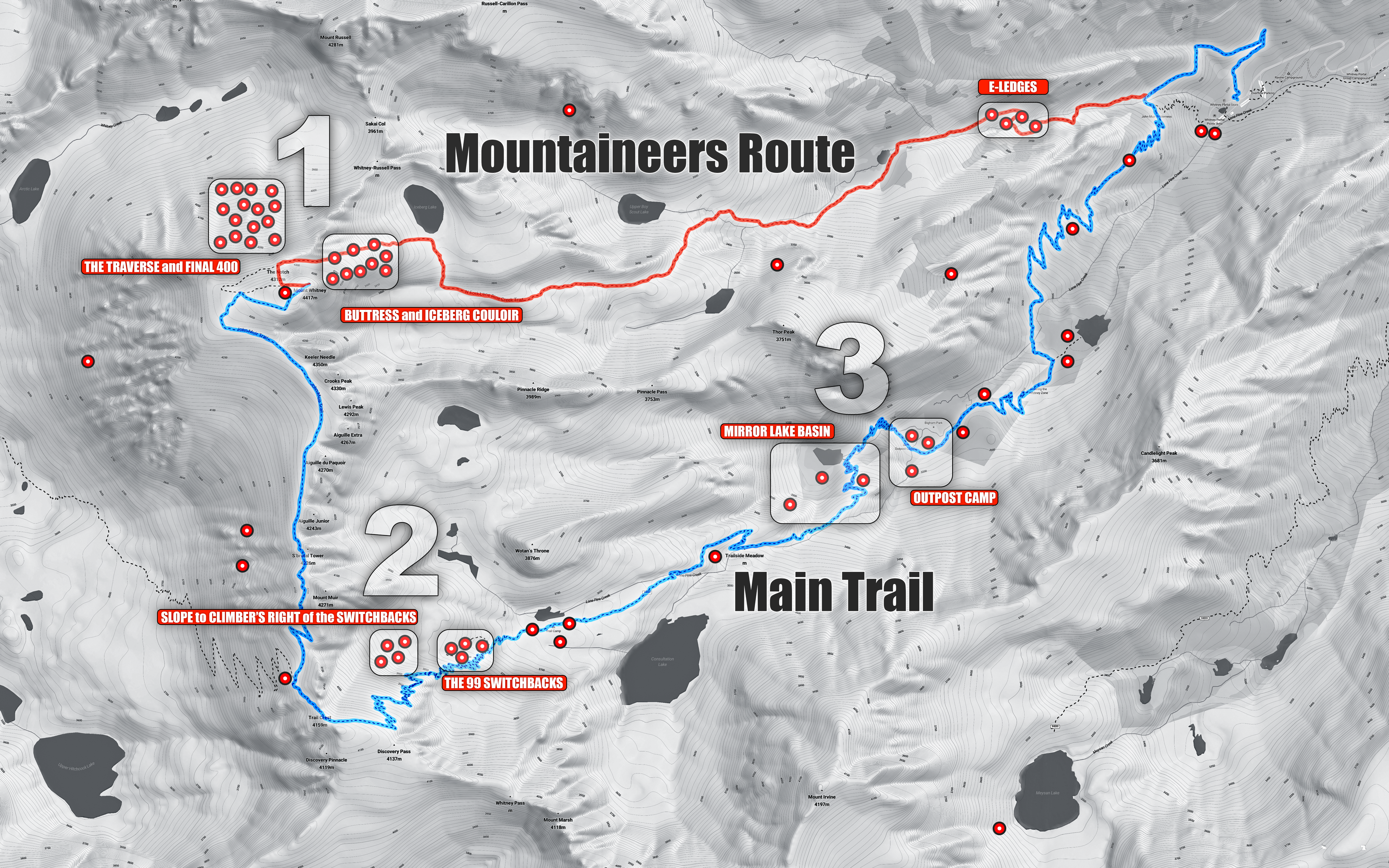
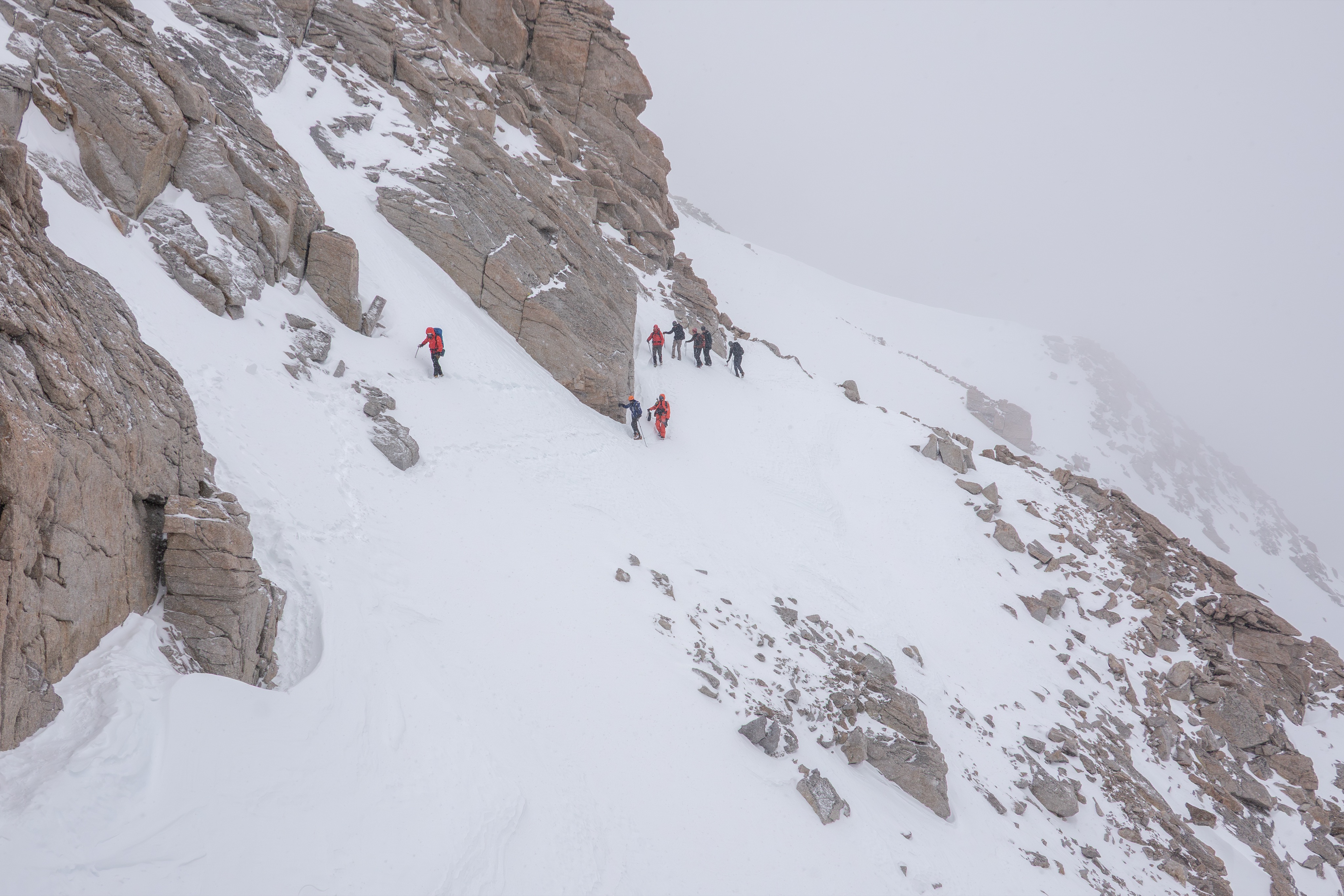
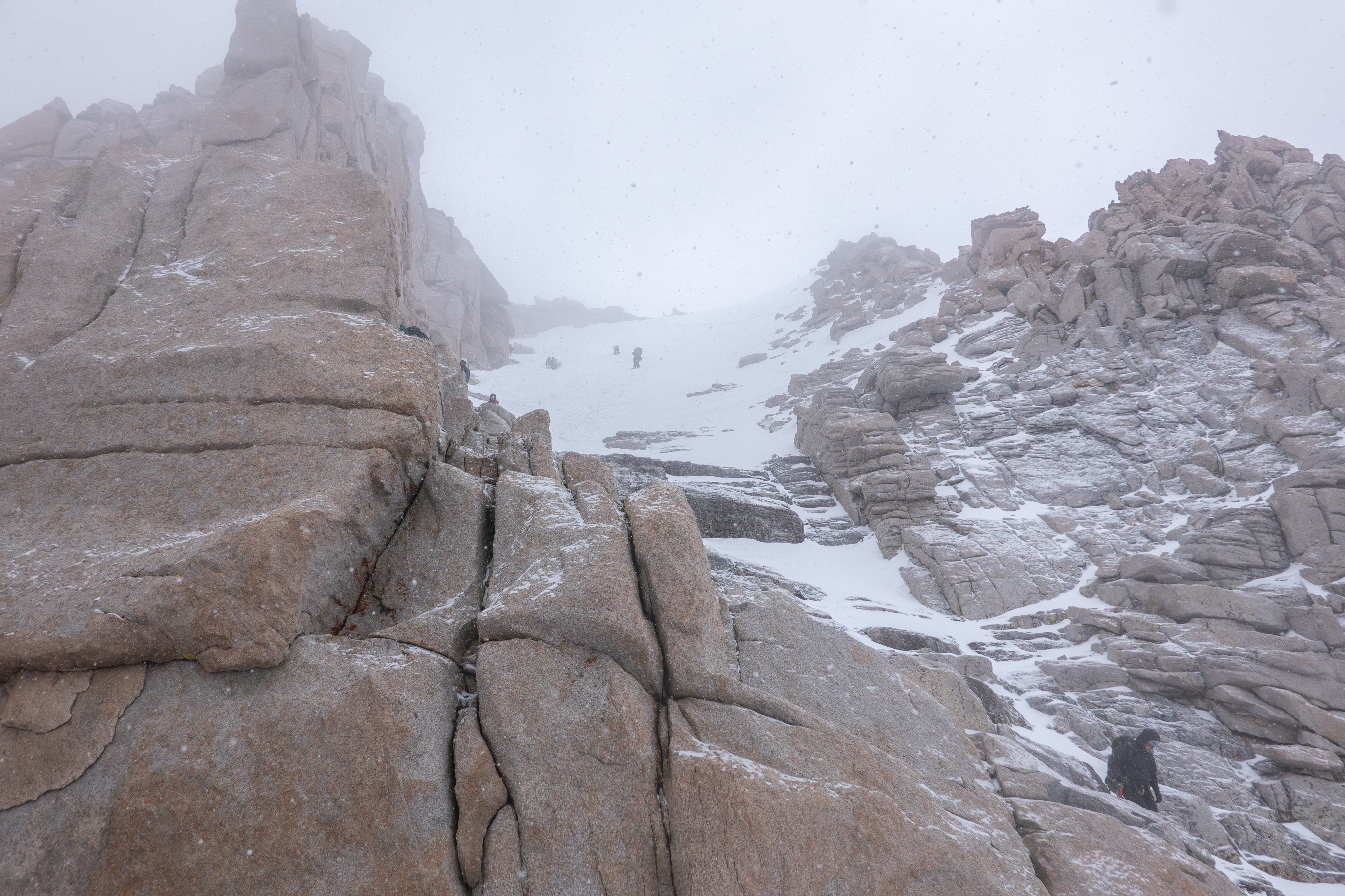
"The Final 400" and "The Traverse" are connected both geographically and as a hazard zone. Together, they represent the most dangerous place on the mountain. The Traverse, also called "The Easy Walk-off" (or "The 2nd Class Trail"), is a short section above the North Face that leads directly west from The Notch, at 14,100 feet. It is so named because it's sometimes used as a "walk off" for multi-pitch trad routes on Whitney, which are usually done in Summer months. There have been many fatalities resulting from hikers and climbers taking this "Easy Walkoff" when it's snow-covered, typically with inadequate gear. Many people get this far into the Mountaineers Route, see the difficulties the Final 400 often poses, manage to ascend it, then realize they can't down-climb it, and choose the "Easy Walkoff" as a descent route thinking it's easier and safer. It's neither, in most conditions. The Traverse is frequently covered with very firm, marginally arrestable névé, faceted snow on top of ice, or firm ice coated with dust and dirt from rockfall events.
Fatalities here have been the result of lost footing and failures to arrest falls.
(See below for an expounded explanation of exactly why the "Easy Walk-off" is not...)
](/media/articles/danger-zones-mount-whitney/LFCSAFTD.jpg)
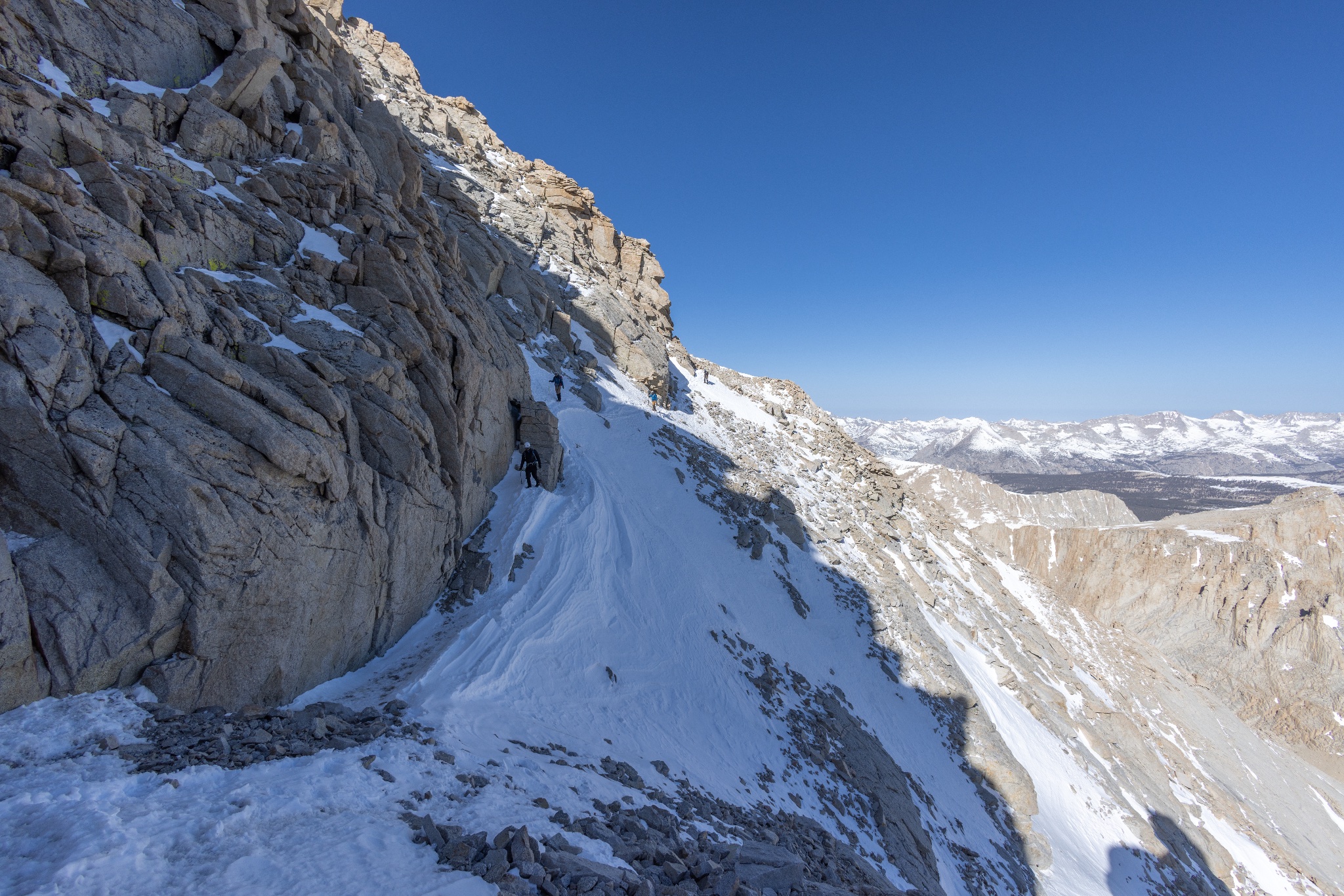
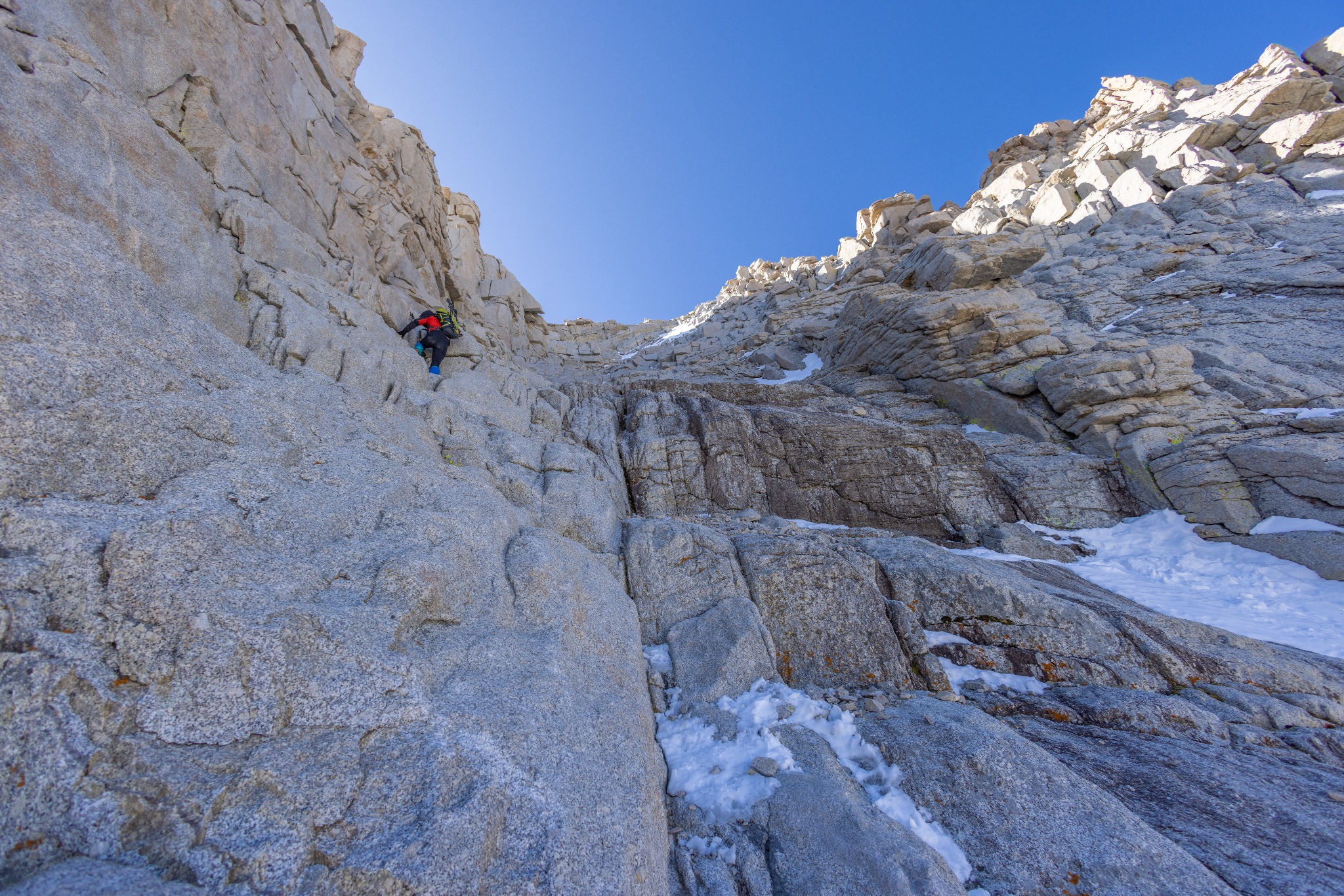
The Final 400 is the last section, and crux, of the Mountaineers Route. In Winter-adjacent conditions, It's usually non-arrestable mixed terrain: firm névé interspersed with granite ledge systems, so proper crampon technique and ice ax placement are critical. When it's dry, the entire couloir is loose rock with islands of stability. Proper route finding is imperative and rockfall is common. All of the fatalities that have originated from falls within the Final 400 couloir have occurred in Winter-adjacent conditions: falls and failures to self-arrest.
The 99 Switchbacks and
The Slope To Climber's Right
The Main Trail | 8 Fatalities
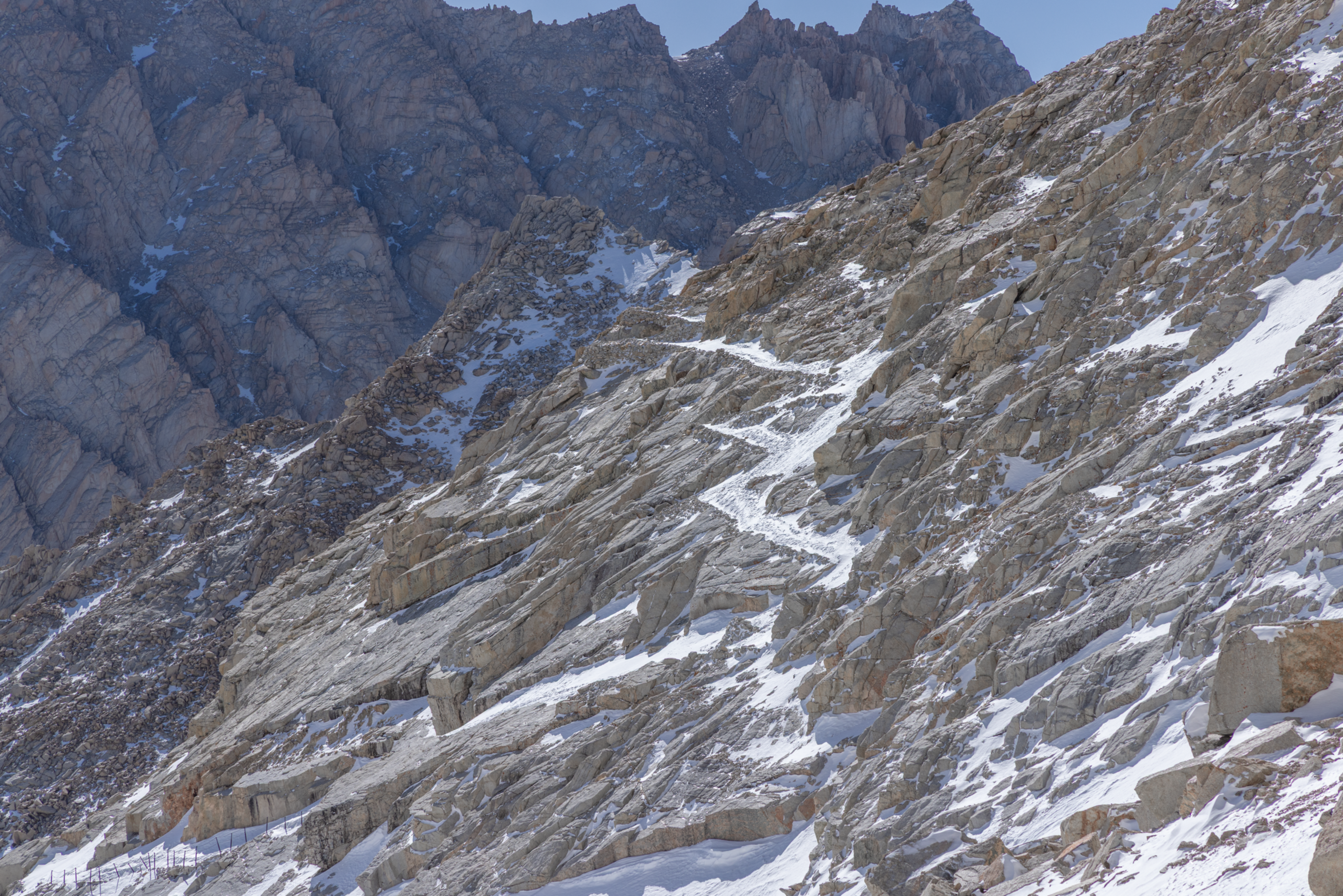
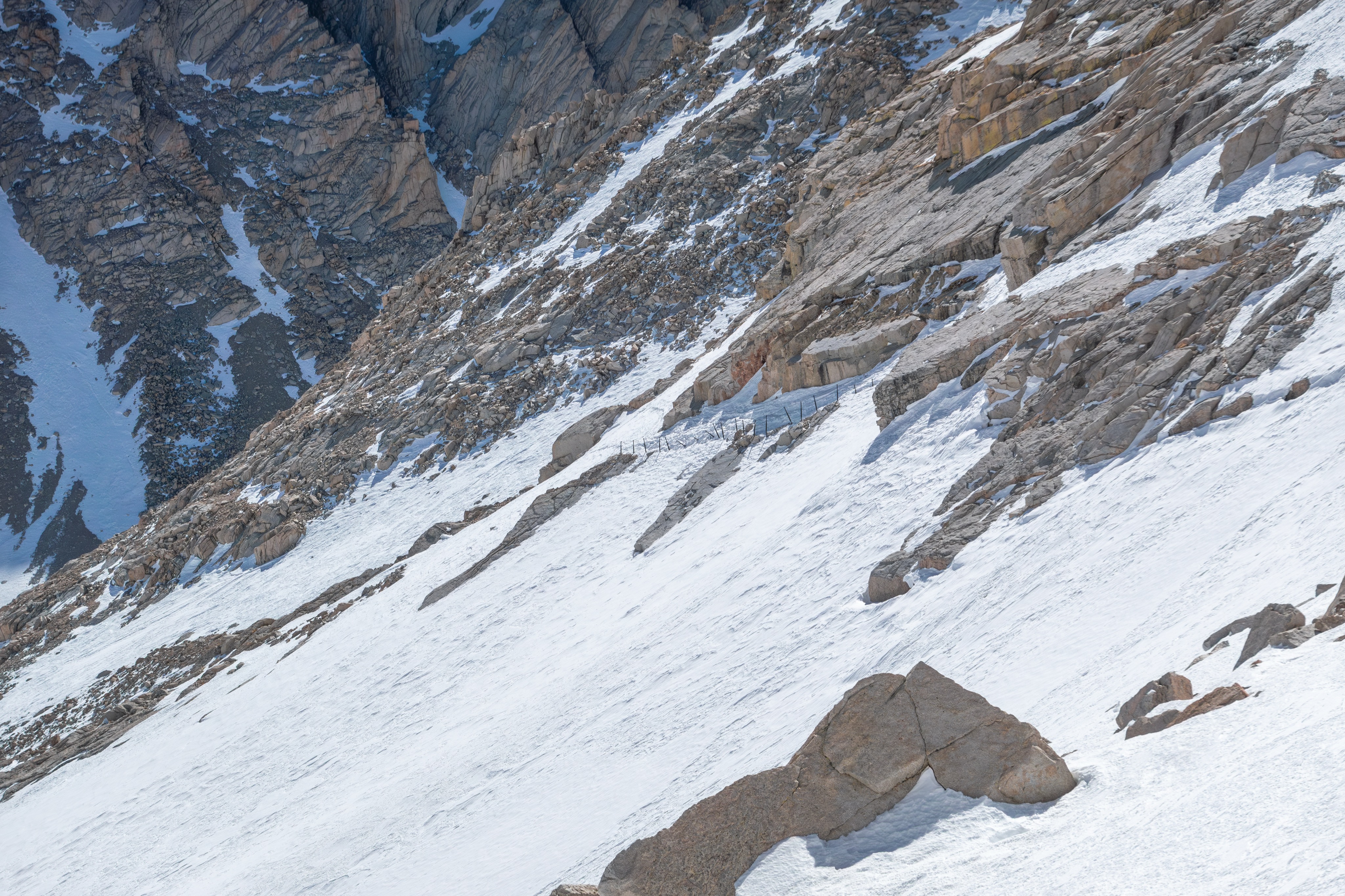
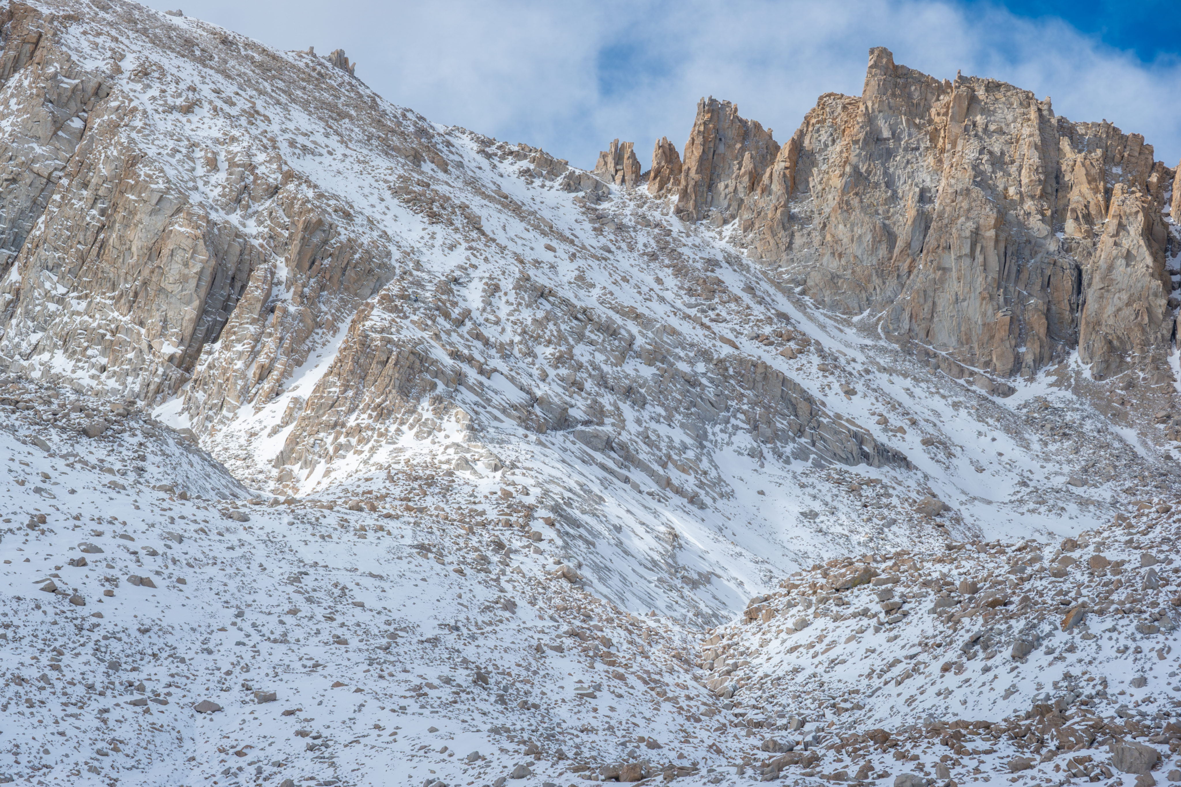
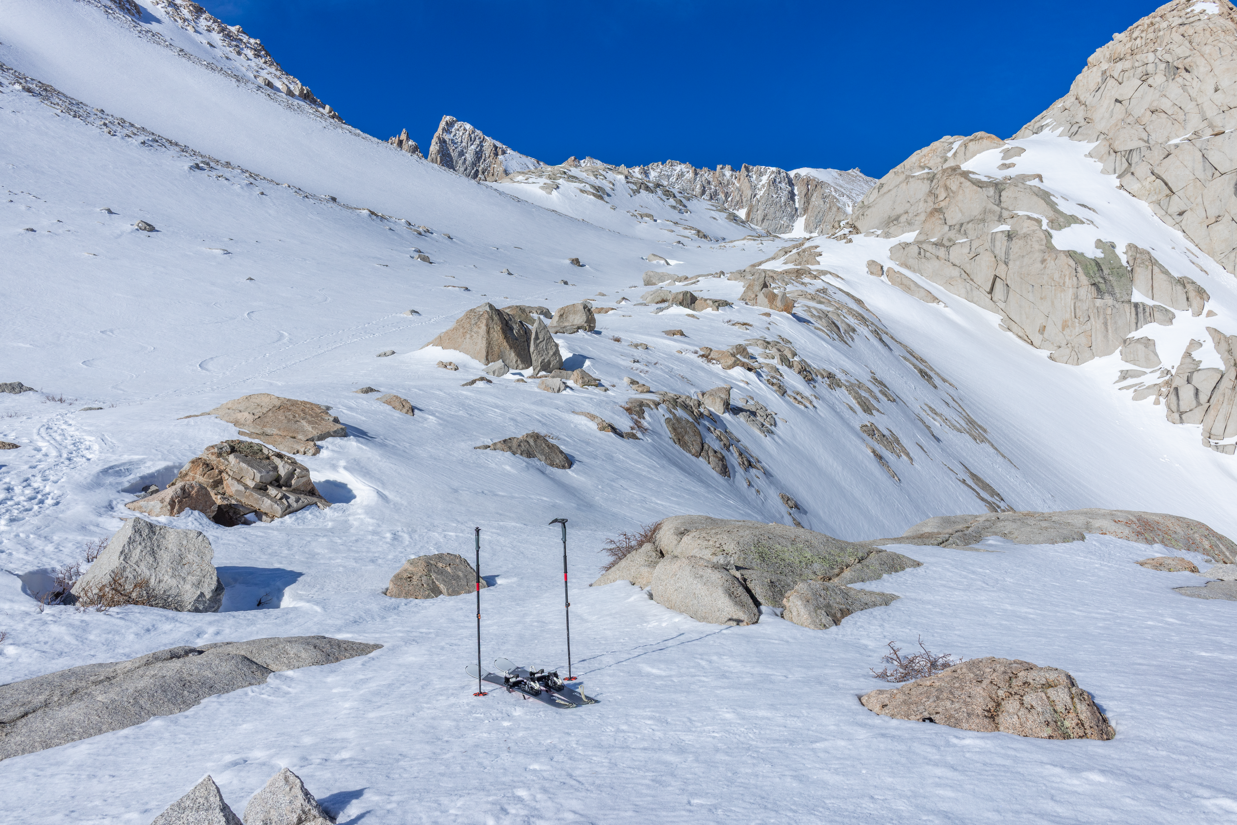
The 99 Switchbacks are an infamous feature on the Main Trail. In dry Summer conditions, most people find them to be the crux of the route. In shoulder season or Winter-adjacent conditions, they are snowed-in and non-viable. In such conditions, The Slope To Climber's Right of the Switchbacks becomes the safest route, one that falls squarely into classic mountaineering territory. The main slope is 35º in places and ascends about 900 vertical feet. It refreezes early in the day, due to terrain occlusion and aspect. It's a rockfall zone. It's often glissaded (see Brambila incident), and it is often attempted in microspikes, with trek-poles and without a helmet. The result is multiple injurious or fatal falls of hikers in mountaineering terrain.
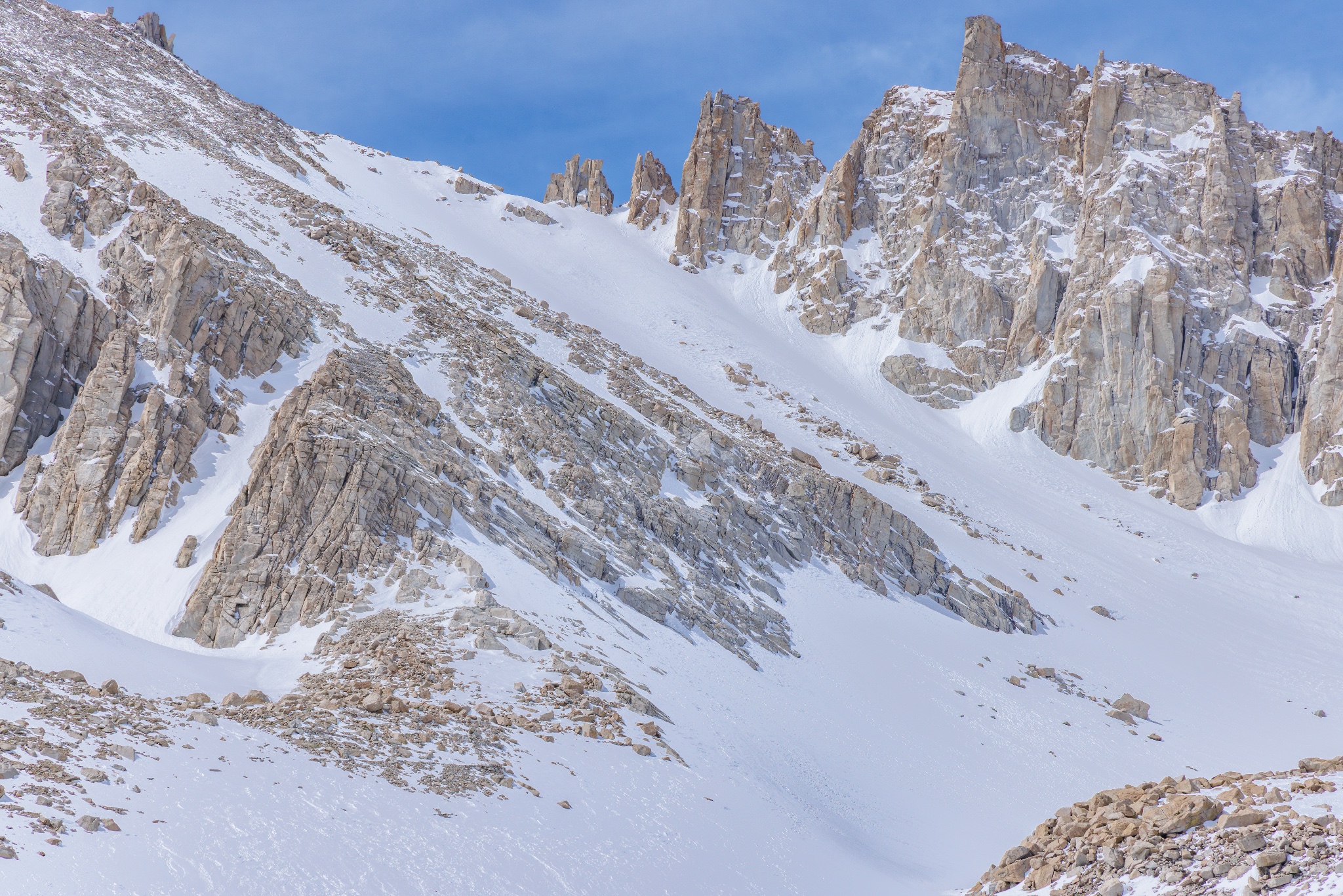
Half of the fatalities and many of the injuries requiring rescues that have occurred in this area have been on the actual Switchbacks, attempted when they're either completely snowed-in or during tricky conditions in the Spring or Fall shoulder seasons, when enough snow exists on the route to make it dangerous, but not enough to make it look dangerous to those with insufficient credible experience in similar terrain. The fatalities that have occurred here have been slips on ice/névé, with or without microspikes, and subsequent falls down steep, mixed terrain of rock-bands and ice.
The Slabs Above Mirror Lake
and Outpost Camp
The Main Trail | 6 Fatalities
Mirror Lake sits in a granite basin below the East Face of Wotan's Throne at 10,700 feet on the Mail Trail. The trail emerges from the tree-line below and enters the alpine environment, then winds along an exposed granite ridge above Mirror Lake. Some people return to this section after summiting late, having been on the trail for 18+ hours, dehydrated, hypoglycemic, and exhausted. People sometimes lose the trail here, parties separate, and people end up cliffed-out and in need of rescue. Some of them fall down various rocky chutes or snow-filled couloirs and do not survive.
The E-Ledges
The Mountaineers Route | 4 Fatalities
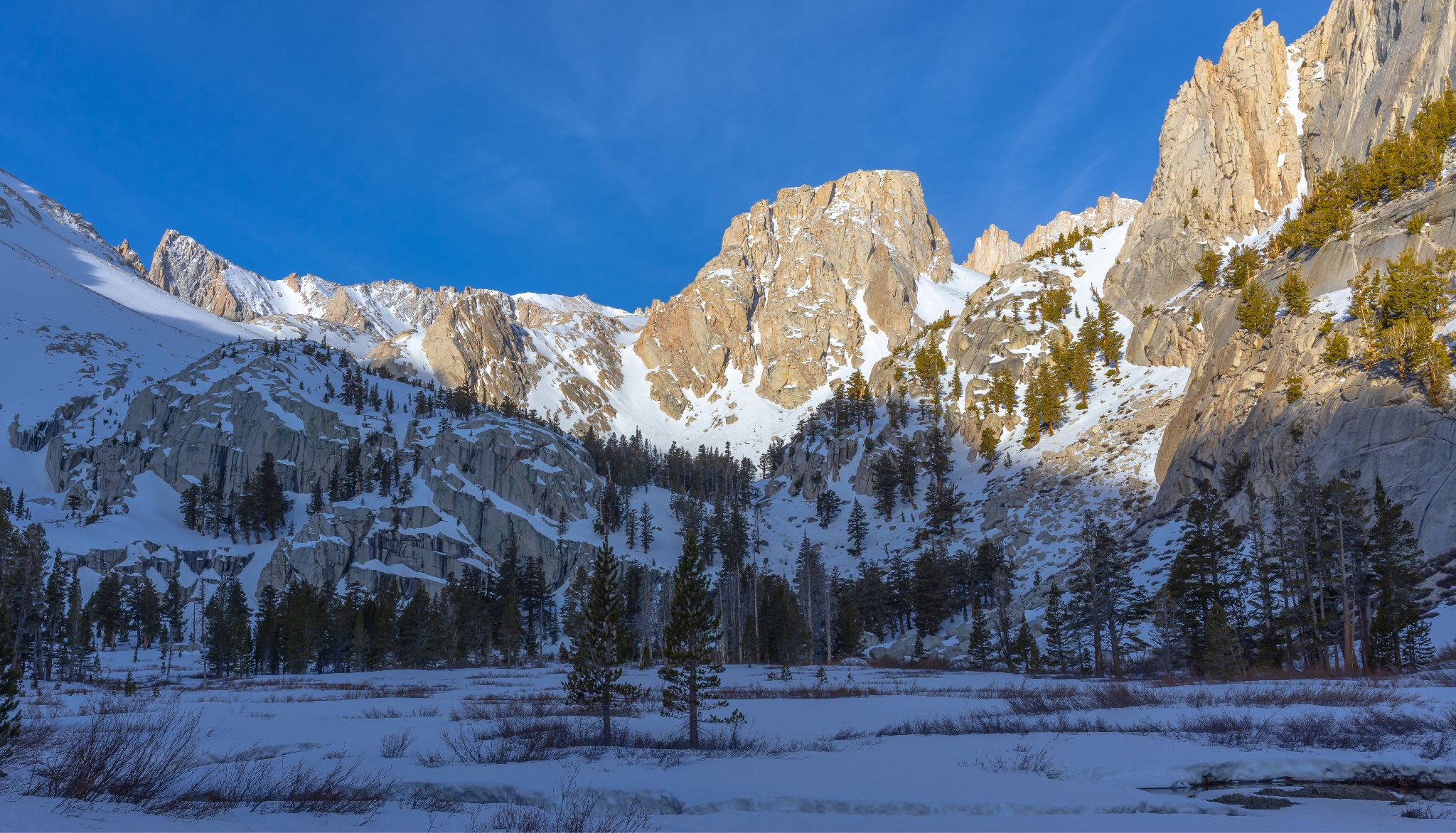
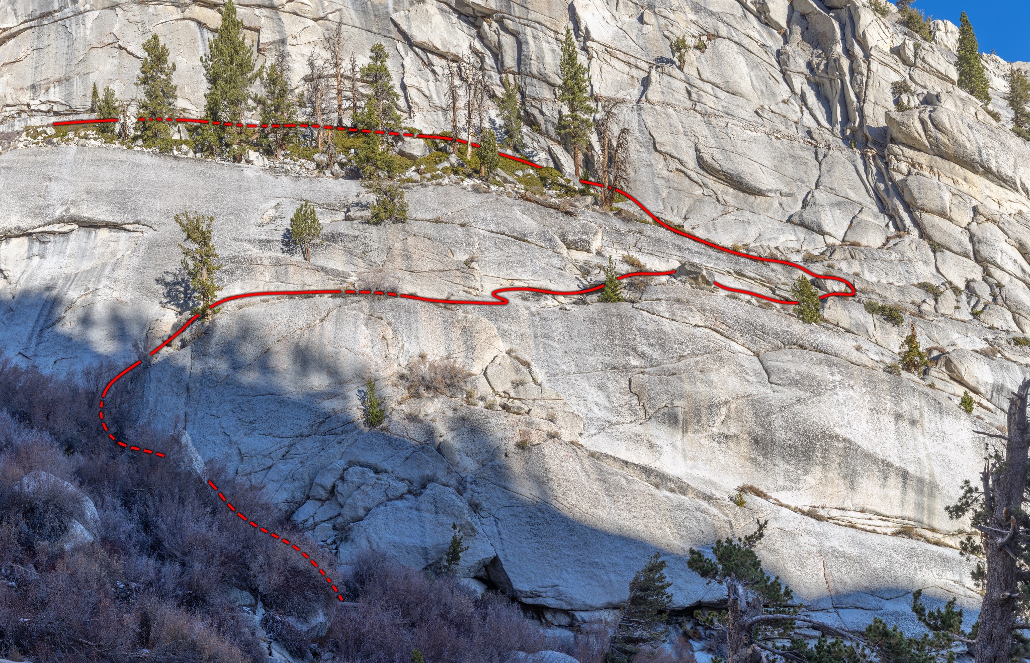
The cliff and ledge system feature at the very start of The Mountaineers Route is called the Ebersbacher Ledges, known locally as "The E-Ledges". While exposed to falls, it is very short and does not require any technical climbing. Injuries and fatalities here have been the result of off-route falls and rockfall events.
The Iceberg Couloir
The Mountaineers Route | 3 Fatalities
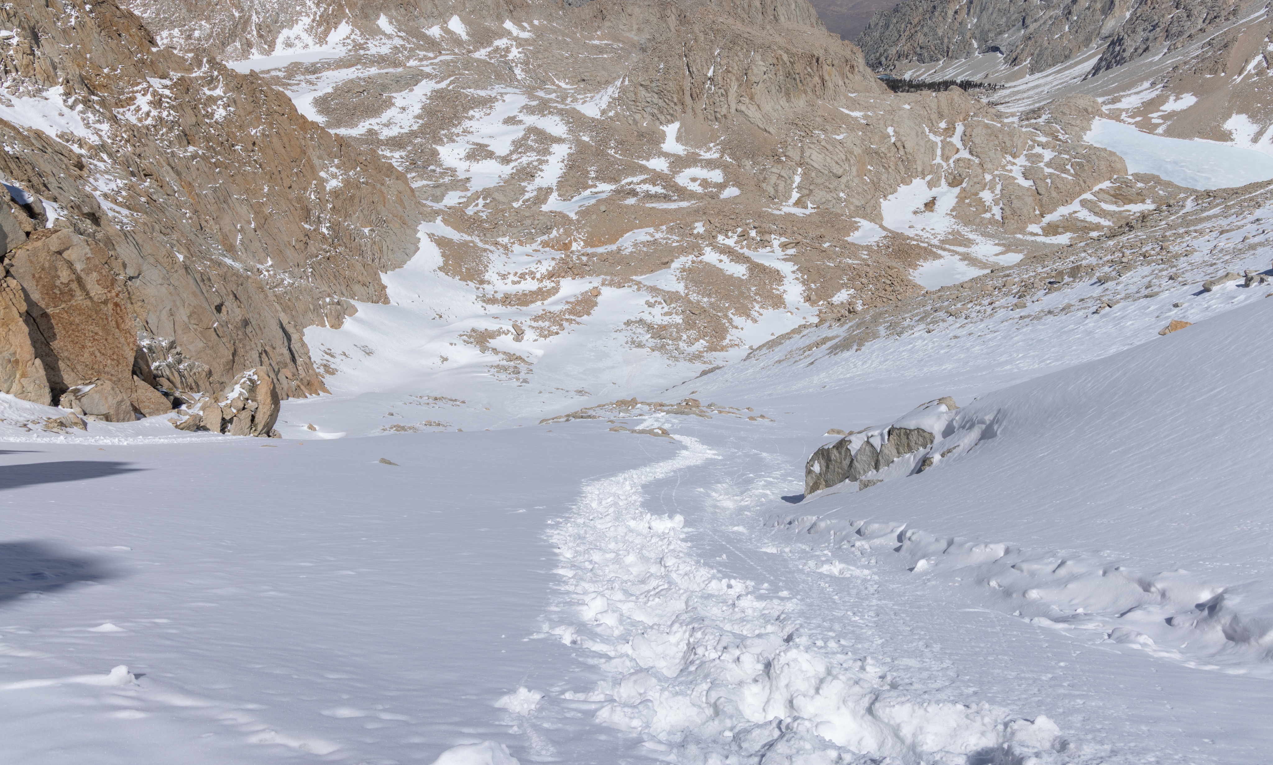
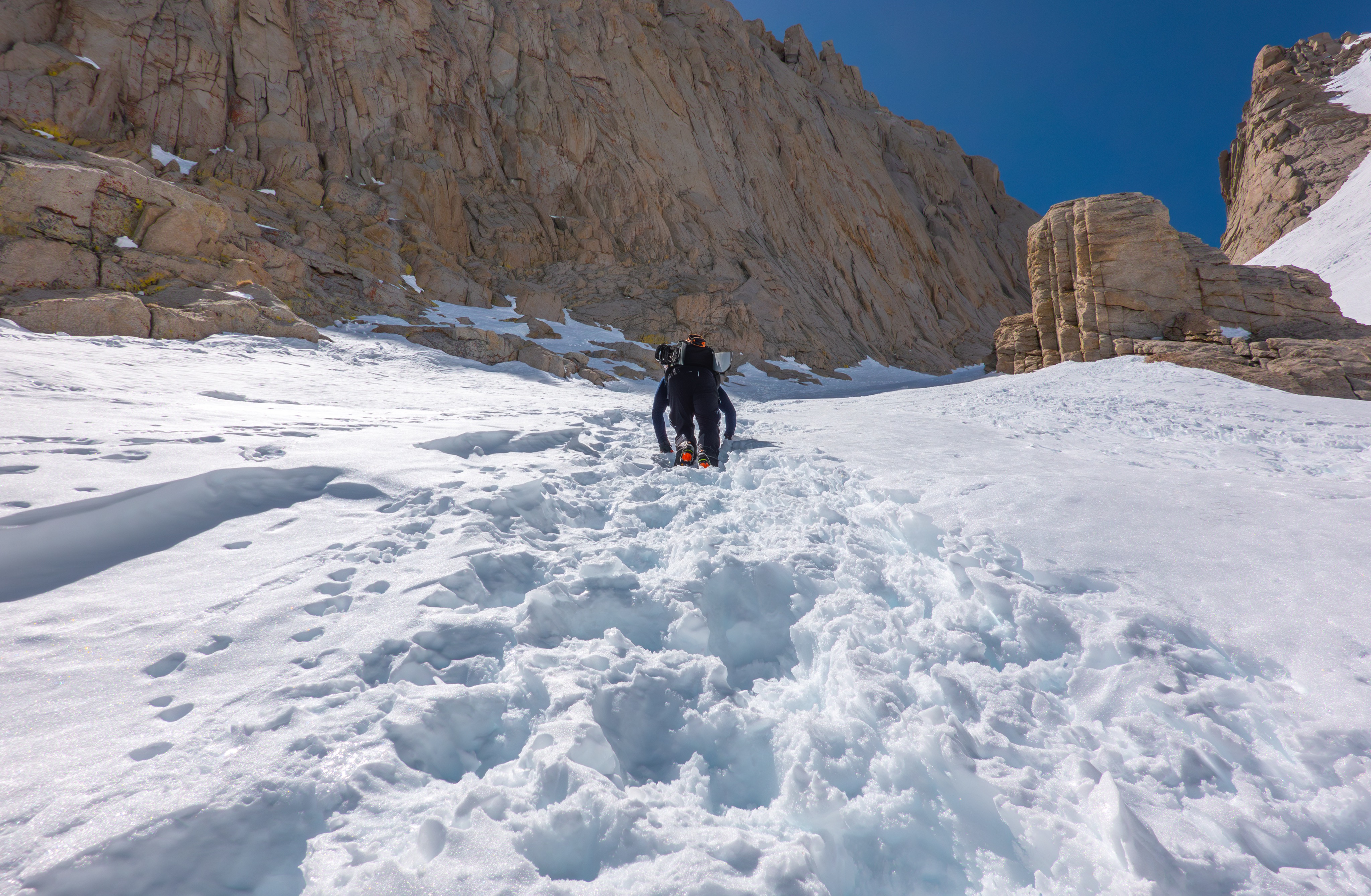
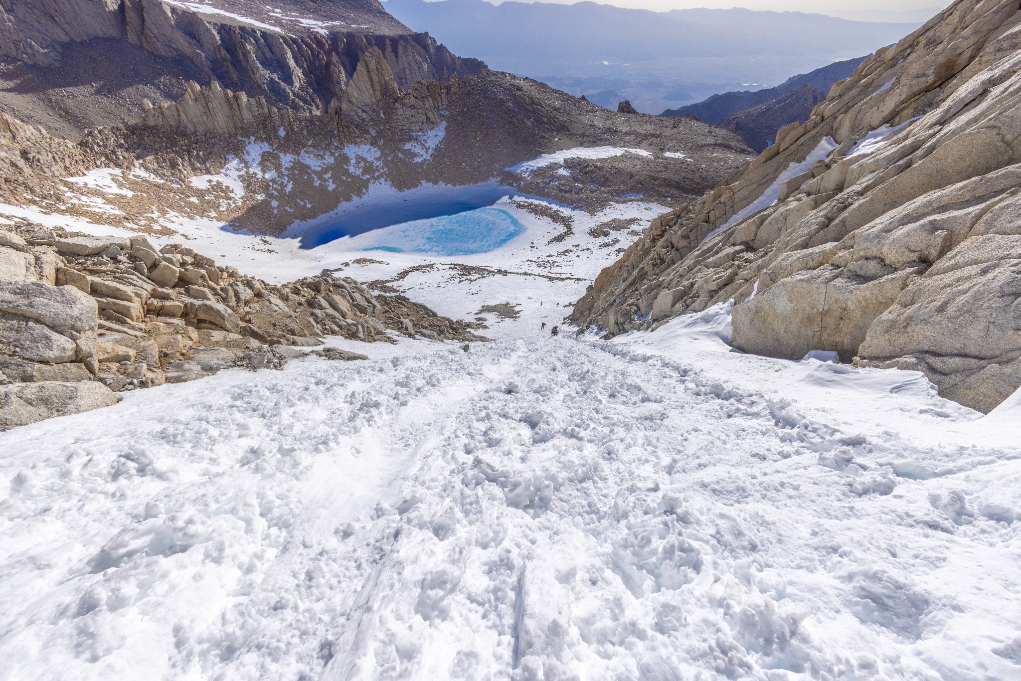
A moderately steep (35º) 1,450 vertical-feet couloir exists between Iceberg Lake and The Notch. The fatalities here have all been lost footing, failure to self arrest incidents in shoulder season conditions. In the Summer, the entire couloir is loose and rockfall is common.
](/media/articles/danger-zones-mount-whitney/LookingDownTowardsIceberg.jpg)
Technical Routes on the
East Buttress and East Face
The Mountaineers Route | 6 Fatalities
The most recent fatality incident here was a double fatality on September 6th, 1991. Prior to that: 1982, then 1973, then all the way back to 1950, another double fatality incident that killed the heir to the R.J. Reynolds tobacco fortune. There have been many rescues and self-rescues on the East Buttress and East Face routes, since.
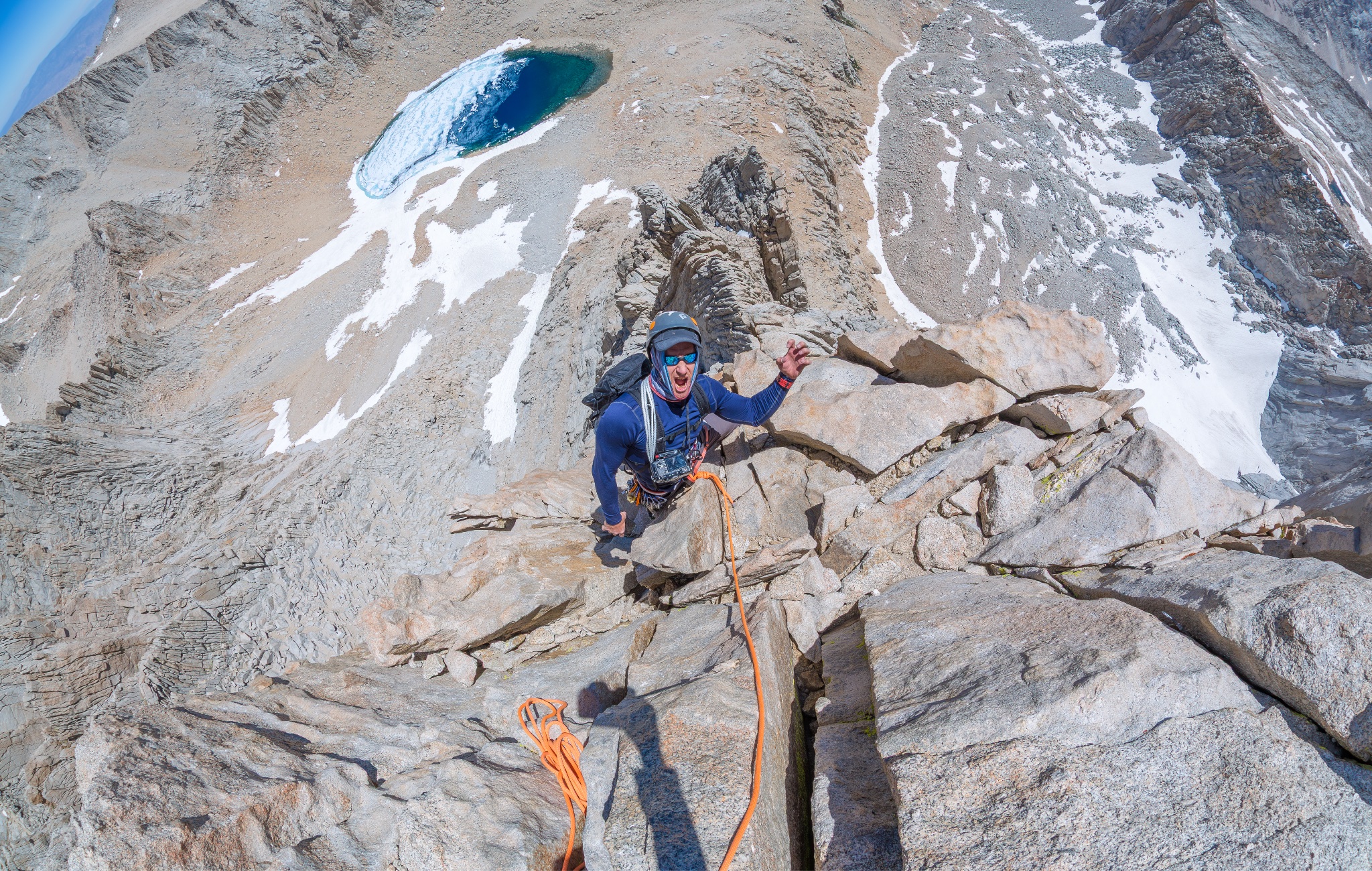
Specific Route Advice and Common Hazard Mitigation Failures
Mountaineers Route
Gully below Lower Boy Scout Lake
In early season attempts on the Mountaineers Route, the North Fork Lone Pine Creek gully sometimes holds enough snow to bury the trees that grow there. Under such conditions, the E-Ledges can be bypassed. As this gully melts out, snow bridges form over the stream and trees and it becomes hazardous. Snow-bridge collapses and ice calving off of the north-facing walls of this gully have resulted in helicopter extractions.
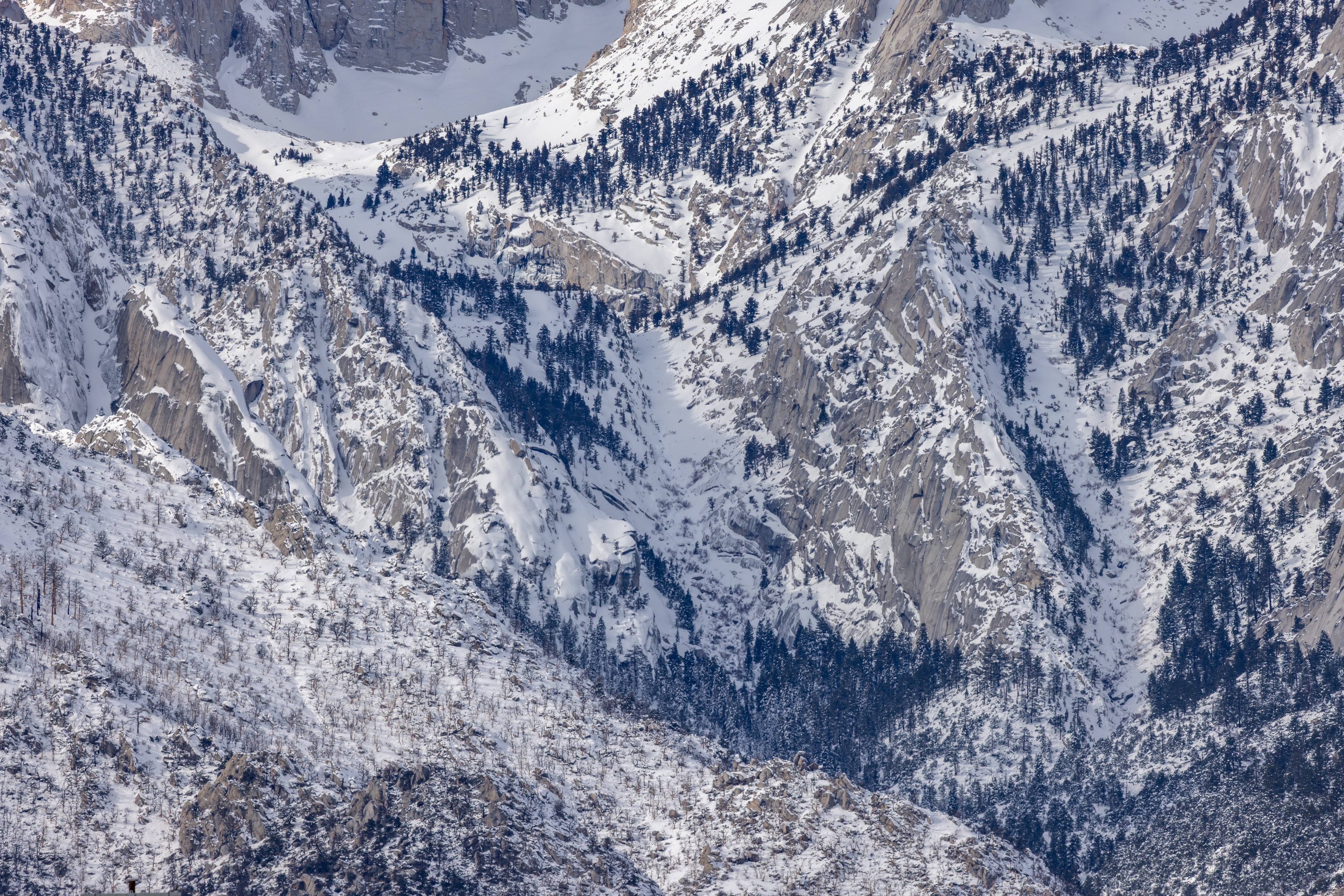
E-Ledges
Helmet use in this section is both rare and highly recommended. The mechanism of injury and fatality here has often been rockfall events, naturally triggered by adverse conditions, or triggered by other climbers on the route.
Couloir between Iceberg Lake and The Notch
This is standard classic mountaineering terrain when snow is present. Typical gear and mitigations apply: crampons on mountaineering boots, ice axes and helmets. The couloir refreezes very early in the day. In some months, parts of it never sees sun (here's an amazing tool...) Ascents and descents should be timed to accommodate. Without snow, it's a rockfall zone; route-finding is critical and helmet use is wise.
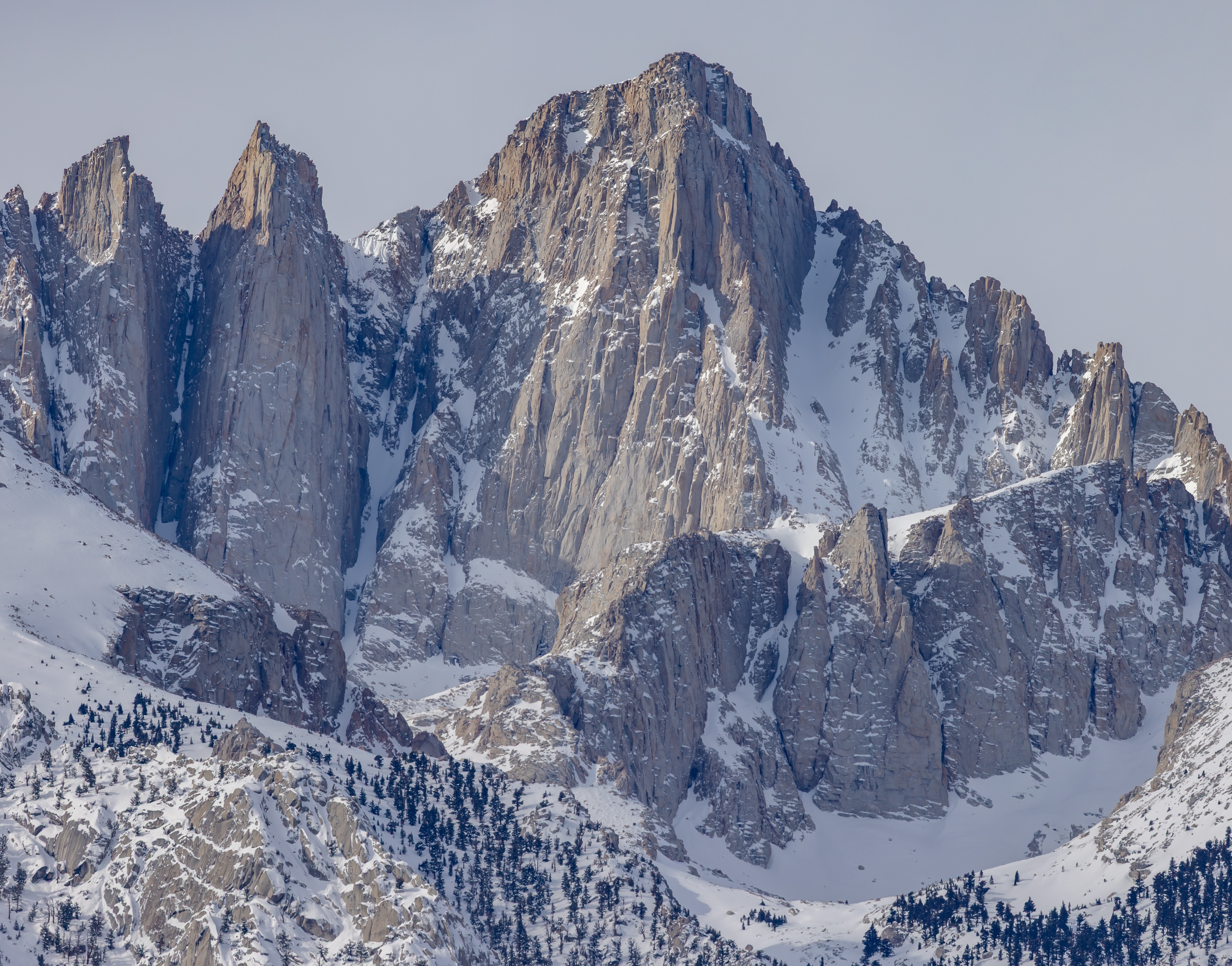
Final 400
Similar mitigation for the Iceberg Lake couloir with the added caveat that this terrain is frequently non-arrestable and it is extremely exposed to unsurvivable falls down the North Face. Two technical ice axes offer fast and safe ascents and descents when snow is present. Rappel stations are sometimes rigged by climbers. Fully inspect all in-situ rap tat. When dry, the talus blocks on climber's right are fairly solid. If you're pitching this section out, good gear placements can be found on climber's left.
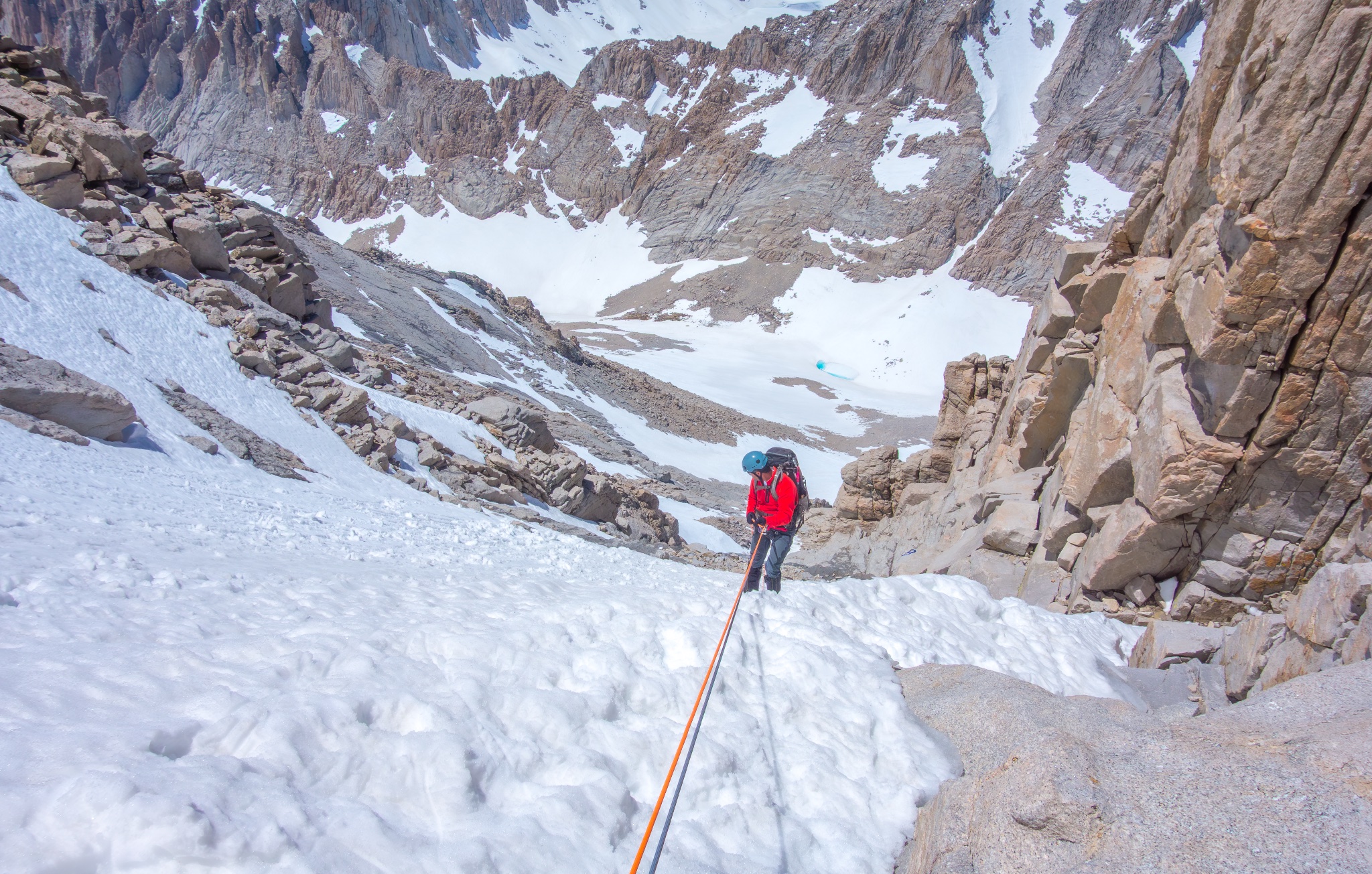
The Traverse
Mitigation is simple: don't take The Traverse when snow is present on the route. When snow is not present, it's loose and subject to slides and rockfall. It's not a recommended route solution in general, and it's not even the route. (It can be argued that The Final 400 is the entire reason to climb the Mountaineers Route in either totally dry conditions or during Winter-adjacent ones).
Because this section of the mountain is notorious, here are more details about why it is:
1.) It’s a 45° North-facing slope at 14k feet over about 1800 vertical feet of unsurvivable mixed fall terrain. (Intervening bands of rock and ice).
2.) It’s very frequently non-arrestable. It’s usually only marginally-arrestable. Sometimes it’s very firm névé, sometimes it’s softer snow on top of a sheet of ice (sometimes it’s loaded with fresh snow and avalanche-prone, though that has not been a fatality trigger there yet, that I’m aware of). These conditions are typical of steep, North-facing terrain at 14k feet. The reasons for this are a little more complex than what is obvious, but there are lots of contributing factors (steep couloirs above that both slough snow during storm events and leak water during melt-freeze cycles and deposit the results lower down, where it refreezes, successive wind-loading over the ridges above that create firm snow deposits on leeward slopes, or wind-scouring that successively removes soft snow and leaves firmer snow, for example).
3.) Many people can’t or don’t properly read alpine terrain, so they are unaware of all this, and they attempt the Traverse for inappropriate reasons and at inappropriate times (they can’t descend what they ascended due to lack of gear or experience. Lack of experience in terrain like this leads them to believe the Traverse is “easier”, etc).
3.) It’s sometimes done with inappropriate gear (microspikes, trekpoles, no helmet) with inappropriate technique.
4.) Traverses in steep, non-arrestable terrain are mechanically more difficult and dangerous than straight up or down front-point ascending and descending for a few reasons; a traverse in steep terrain is a series of step-throughs; every inside step (your uphill foot) is a step-through of the frame that your downhill foot, body and ax placement create with the slope, the steeper the terrain, the more pronounced the step-through. Step-throughs increase the likelihood of gear/clothing/terrain snags, that then lead to trips, that lead to falls…that likely cannot be arrested. Direct ascents and descents straight up and down 40° terrain with two axes allow for a series of very secure belays (foot-foot-ax or ax-ax-foot) in a position that ensures those belays are solid (body weight directly over crampon frontpoints and ax placements in piolet appui grip (middle dagger) or plunged. Traversing; unless done face-in with two axes while front-pointing, only allows for two-points of contact (foot-foot or foot-ax) that are less bio-mechanically balanced and more prone to the kind of instability and failure that precipitates (unarrestable) falls down unsurvivable mixed terrain of rock and ice.
In short, "The Traverse" is an Alpine Venus Flytrap that lures in people who have not yet gained the credible experience in similar terrain and conditions to understand the dangers it poses and how to mitigate those hazards. Summit fever leads people to ascend what they cant descend, so they then decide on the option that “looks safer”. It's not.
Don't take "The Traverse"...
The Main Trail
The Slabs Above Mirror Lake
GPX routes in phones and watches can prevent the most common motivating factor to negative outcome incidents here: getting off-route in the dark and falling down a rock chute or snowy couloir. Secondary factors that contribute here are party separation and exhaustion. Parties should always move at the speed of the slowest member. In general, it is a bad idea for hikers to separate, unless all involved are highly experienced in the exact terrain and conditions that exist at the time, all are capable of self-rescue, all have sat-comms or a similar means of communication, all are familiar with the route and are fully capable of independent navigation even during inclement conditions, all are equally properly equipped and a solid, clear logistical plan is agreed upon ahead of time that covers all contingencies in the event of one or more of multiple failure modes.
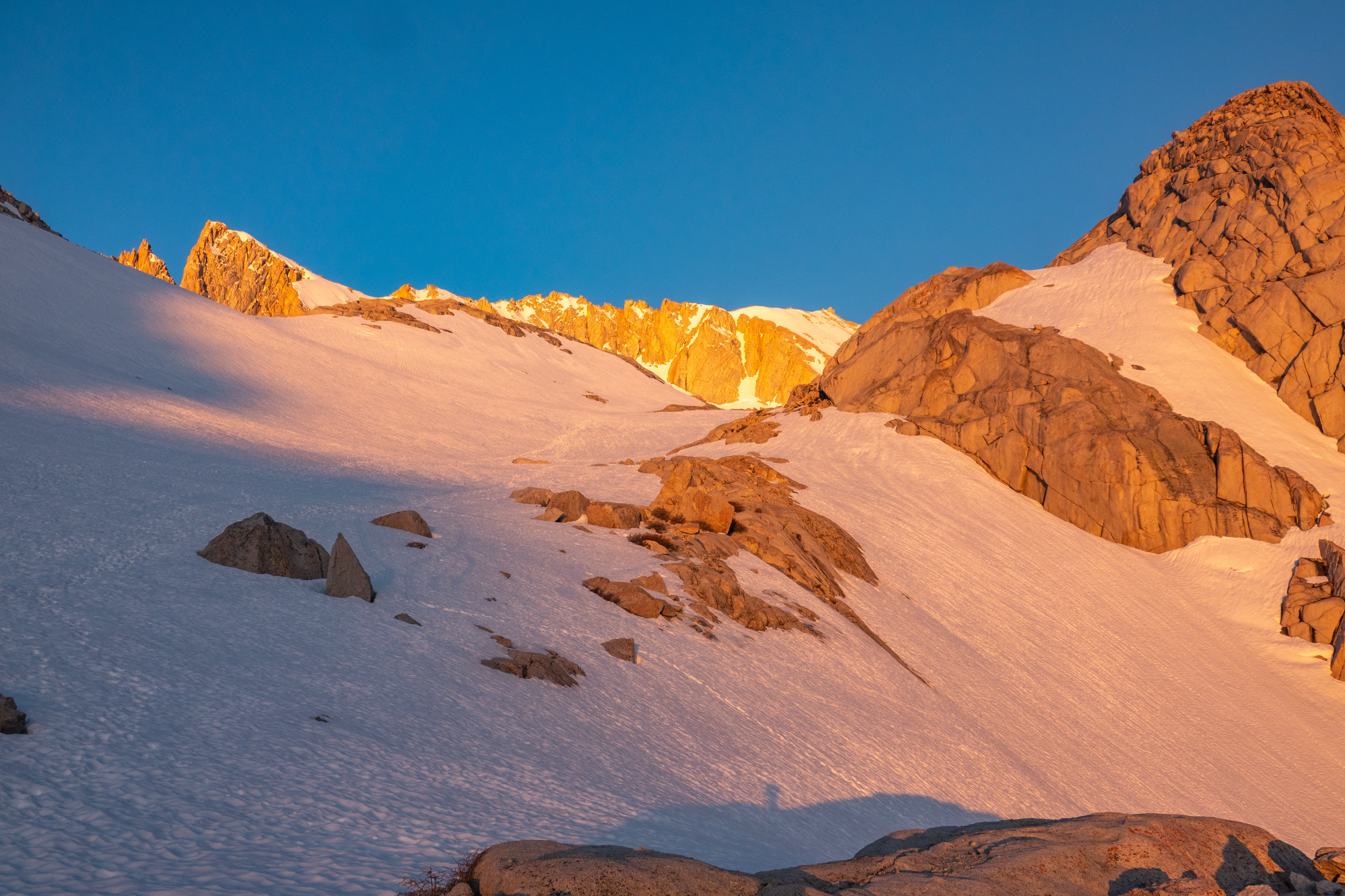
Trailside Meadow fall zone
There is a short section of the Main Trail directly above Trailside Meadow just prior to Trail Camp that presents high-consequence exposure for a very short amount of time: early Spring shoulder season, when steep, wind-driven snow-drifts covering the trail have solidified into firm névé. Depending on when you arrive here (time of day, time of year), it's sometimes worth a gear transition into crampons/ax/helmet. This section is avoidable by taking the "Winter Route" from the Slabs Above Mirror Lake. Exit to your left onto the snow and walk up gentle snow slopes with Trailside Meadow below you and to your right, directly into Trail Camp. Here's a trip report...
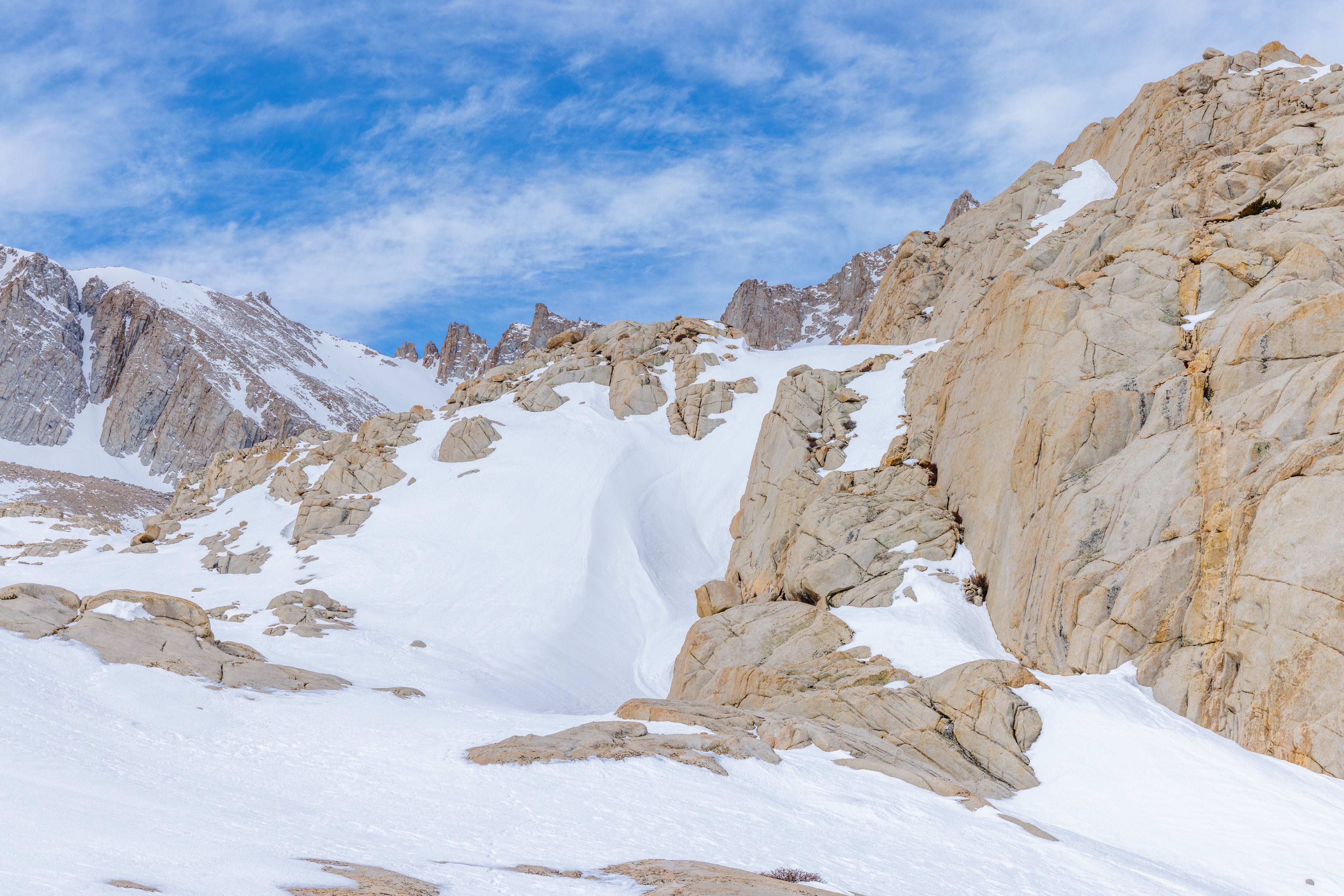
Slope to Climber's Right of the SwitchBacks
Ice ax, crampons on mountaineering (or adjacent) boots and helmet. Microspikes and trek-pole use here is a consequence multiplier that has led to fatalities. Time ascents/descents properly: firm on the way up, soft on the way down. Do not attempt to glissade marginally arrestable or mixed conditions here; doing so has led to fatalities and countless injuries. (See Brambila incident)
99 Switchbacks
If they are inundated with snow and ice, bypass them and ascend The Slope To Climber's Right. The 99 Switchbacks are only a valid route choice when they're dry. If attempting them in marginal conditions as they are melting out, they are a rockfall zone and helmet use is wise.
.](/media/articles/danger-zones-mount-whitney/cable-section.jpg)
A (VERY obvious) melt-freeze induced rockfall zone.
General Mount Whitney Advice
If it looks dangerous, it likely is.
(Many times, when it doesn't look dangerous, it actually is). Turning around before the terrain and conditions exceed your ability or knowledge should be an easy decision. Some find doing this difficult due to a misalignment of perceived danger to actual danger, coupled with inappropriate motivating factors. Don't let common heuristic failures (Social Proof, Normalcy Bias, etc.) guide your hazard mitigation process.
Mount Whitney is a big mountain.
It presents real dangers that have fatal outcome potential. Remembering that when you're there and you are tasked with making a decision based on what you are experiencing is crucial. Recognizing when you have reached a maximal point in your cumulative risk loading tolerance makes decisions easier.
Mount Whitney by any route when significant snow is present isn't just (only) hiking.
…it's a mix of hiking and what lies on the other side of the Line Of Demarcation. For attempts on either route during those times, this often means classic mountaineering. In very general terms, during the Spring shoulder season in the Sierra, which sometimes includes July, Mount Whitney is hiking below the tree-line and sections of classic mountaineering above it. Trail Camp (Main Trail) or Iceberg Lake (Mountaineers Route) is usually where this line of demarcation begins to matter. A successful Whitney attempt under these conditions (by either route) means addressing the requirements of both hiking and classic mountaineering.
Caloric requirements and hydration needs.
It's very common for hydration and caloric needs to be both underestimated and neglected, especially at elevation. Determining your average hydration and caloric consumption rate per hour in varying types of terrain and conditions takes time and experimentation, but pays huge dividends. Understanding how far and how many vertical feet you can go in a given environment with a given amount of water and calories makes mission planning formulaic and removes guesswork. All that's left is to crunch the math and stick to it, every hour on the chronological hour. As a very general rule; target 200 calories and 250ml of water every hour.
If you're doing a day-hike, carbohydrates are the go-to calorie source.
Acclimatization is extremely important.
Consider the fact that it takes about two weeks to become properly acclimatized to 14,000 feet. Approximately nobody actually does this for Mount Whitney. Most people are on very truncated schedules and spend far too little time acclimating. Devote an extra travel day to it at the very least. Driving from a low elevation and attempting to sleep at 10k feet (a common occurrence for Mount Whitney aspirants who sleep at Horseshoe Meadow) is not as effective as people think it may be. Most people have trouble adjusting to 10k feet immediately, or even days after, having driven up from sea level. If you can only devote a single day to acclimatizing, consider doing a strenuous activity at 10k feet and then returning to Lone Pine to sleep. This protocol usually pays higher dividends for most people. The importance of actual, real sleep is vastly underrated...
(And hydrate, hydrate, hydrate).
The Acclimatization Trap on day-hike schedules.
Ascending from 3,700 feet (Lone Pine) to 14,500 feet and back to 3,700 on a day-hike permit is an exercise in threading the acclimatization needle. The average time for TH-to-summit-and-back day-hikes on the Main Trail in perfect Summer conditions is around 14-16 hours. Many people who do a day-hike at this pace and do not experience any altitude issues do not realize that if their pace was slowed (or stopped completely) due to an injury or some other factor, and they were high above the tree-line when this occurred, they would eventually succumb to AMS and possibly worse. HAPE (High Altitude Pulmonary Edema) cases are very common on Mount Whitney, for example. (There is even a possible HACE case). It is simply not feasible, no matter your level of fitness and your physiological/genetic make-up, to ascend to 14,500 feet with very little or no acclimatization on a day-hike (or trail-run) and expect that you can stay high on the mountain (above 13,600 feet, for example) for extended periods of time (in excess of 24 hours) and not be affected by some form of AMS, possibly severe AMS that has fatality potential. Most day-hikes on Mount Whitney occur in a brief enough time-frame that doesn't allow for the full effects of the AMS ax to drop. Getting as much acclimatization as is possible prior to your day-hike attempt is even more important than doing so for over-night or multi-day attempts, where acclimatization actually takes place on the mountain as you ascend it relatively slowly.
Perceived temperature is not real temperature.
A common refrain you may hear is that "it was hot on the summit of Mount Whitney".
It wasn't. And it never is. The laws of physics prevent it. Lapse rate dictates a 3-5ºF temperature drop per 1000 vertical feet of elevation gain. Lone Pine is 3,700 feet ASL. There's a 10,800 vertical feet elevation variance between the floor of Owens Valley and the summit of Mount Whitney. That variance usually results in a 50ºF temperature drop. When it's 100ºF in Lone Pine, it's 50ºF on the summit of Whitney, and that's about as warm as it gets. Under cloudy skies when it's 105º in the valley, it can flirt with 60ºF at 14k, but it's rare. Perceived temperature is a result of active exertion and direct solar radiation; you can feel overheated when you're high in alpine terrain, but when you stop, and the wind picks up, you quickly realize that this feeling is an illusion. That illusion, if not accounted for, can and does put people in hypothermia territory. Plan your gear around the lowest ambient temp you will experience that day and carry what you need to survive 48 hours after an event occurs (a rolled ankle, a fall, a rockfall injury, etc).
Fitness Matters.
Cardiovascular fitness is the single most important metric that you can tweak to make your time in alpine terrain more pleasant and less prone to failures of many kinds. Attempting big days in alpine terrain without an appropriate level of cardio fitness results in a wide range of very unintuitive consequences. Judging fitness can be a difficult task, as it is widely open to interpretation, but in very general terms, "alpine fit" usually means you've spent the last 2+ years (meaning; a pattern) of your life running 20-40 miles per week or equivalent (80-100 bike miles per week, for example). Gym-fitness is not cardio fitness; resistance training, while obviously very useful and important, does not build cardiovascular fitness in the same way that specific cardio training does. The shortest path to being alpine fit is running...
Spring and Fall shoulder seasons are very different.
For mountaineering boots/crampons/ax to be valid tools in a kit, a base of snow (multiple feet of settled snow that has been through many metamorphosis cycles and has completely filled in all of the talus) needs to be present and your targeted route needs to involve ascending, traversing and descending steep snow slopes. These conditions do not exist during Fall shoulder season, when the snow in the Sierra almost always falls on a dry granite skeleton. The temperatures are less forgiving in Fall shoulder season, but the terrain is more forgiving. The exact opposite is true during Spring shoulder season, where the temps are warming, days are getting longer and the entire mountain above 10k feet is buried under 30 or 40 feet of snowpack. Spring shoulder season can lure people in, but many traps are set and waiting to spring (pun intended) on hikers who do not understand alpine terrain and the hazards it presents.
Modern weather forecasting.
For decades, it's been repeated over and over that "you can't predict weather in the mountains."
Good news: you can! But you need to be sourcing the correct data and the correct systems. Learning to properly do this can be daunting at first, but it will vastly improve your safety and enjoyment of the mountains and alpine terrain. If you plan to spend lots of time in these environments, it's worth the effort to learn and understand how and why mountain weather does what it does and how modern weather forecasting works.
A few helpful links...
Self-arrest vs. Self-belay grip
On Rockfall and Alpine Terrain
Spring Shoulder Season on Mount Whitney
Conclusion
Is Mount Whitney "just a hike"?
It's never that simple in the mountains and Whitney is no exception. What is simple is this:
When it's approached and treated exclusively as one, people are sometimes injured or killed.
Mount Whitney occupies a dangerous place in social lore. The mountaineering community largely ignores it as a worthy objective. The hiking community bucket-lists it and sometimes waits years to attempt it. Hiking season here frequently overlaps with mountaineering conditions in terrain that any mountaineer would immediately recognize as being dangerous with fatality potential. The influx of new hikers into the ecosystem is happening at a faster pace than can be adequately moderated by the mountaineering community and mountain safety outreach in general. So people who don't know what they don't know find themselves in terrain they don't fully understand and the result is exactly what we see, repeated over and over.
If every person who lost their life on Mount Whitney from easily avoidable incidents knew that they were avoidable and understood how to avoid them, they would still be alive.
Please share this article if you know someone who may need that understanding...
-Brandon
(With a big "thank you" to Pete Takeda, without whom, this article would not exist).
Since I wrote this article, another fatality has occurred on The Traverse...