MAY 1st THROUGH MID-JUNE?
What to expect on the Mount Whitney Main Trail. And how to avoid the mistakes that statistically lead to injuries and fatalities during Spring shoulder season attempts on Whitney...
____________________________________________________________________________________
You’ll start your hike on dirt, it’ll feel somewhat warm and pleasant at 8300 feet at the Portal, and the mountain and surrounding area will appear to be dry. Owens Valley will look like the arid desert it is. It might even be hot in Lonepine. You’ll have very limited visibility on the upper mountain and what it holds in store for your day(s).
As you ascend and approach Lonepine Lake, Outpost Camp and Mirror lake, you’ll start seeing patches of snow. Down this low, it won’t matter; you’ll just walk through it, no big deal. If you start very early (0dark:30), the snow you first encounter will be firm and crispy and you might even be able to walk on top of it in places. If you start later in the day, the first snow you get to will be gloppy and sloppy. It’ll be the consistency of mashed potatoes. The boot-track through it will be soft and pliable and it might be pretty annoying to walk in. (And if you start this late on a day permit, you might as well just turn around, because the cards will be stacked against your success up high in these types of conditions, for a wide range of reasons…)
Higher still, above Mirror Lake, you’ll leave the treeline, and the upper mountain will become visible. It will be partially covered in snow; you’ll see a mix of snow and granite (and nothing else; not a pesky tree in sight). The ratio of snow to granite will vary based on when in this time period you’re there.
Between Trailside Meadow and Trail Camp, depending on how aggressive the melt-out is, and (thus) which route you take, you’ll be walking on either majority flat, snow covered terrain (the Winter route from the slabs above Mirror Lake into Trail Camp), or you’ll be on-trail with sections of snow and ice that require some delicate crossings over semi-dangerous fall-lines. (The typical summer trail that switchbacks up above Trailside Meadow). There has been a fatality in this general area (04.21.2021); it was an LFCSAFTD. (Lost Footing, Couldn’t Self-Arrest, Fell To Death). It deserves your attention, as all alpine terrain does.
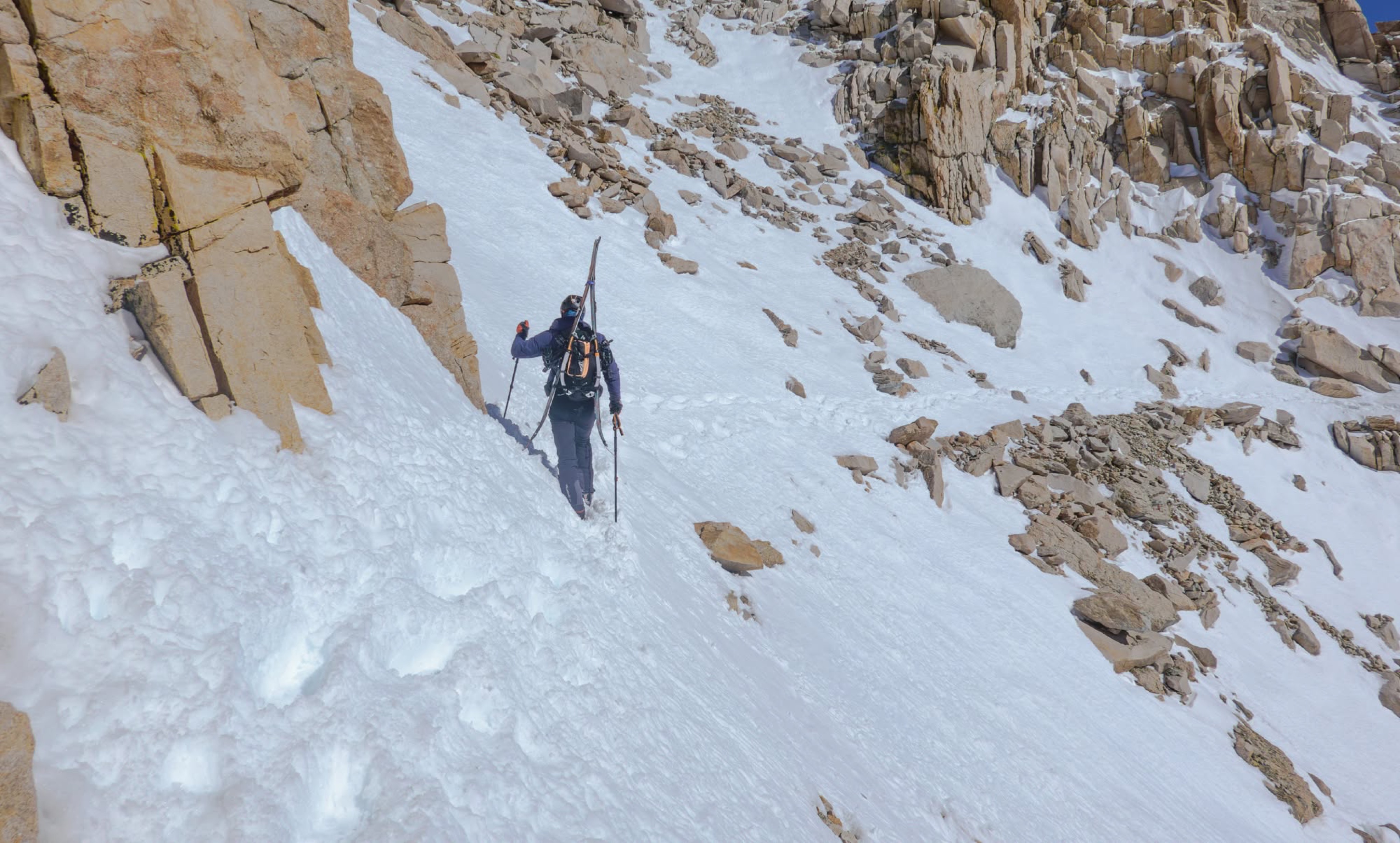
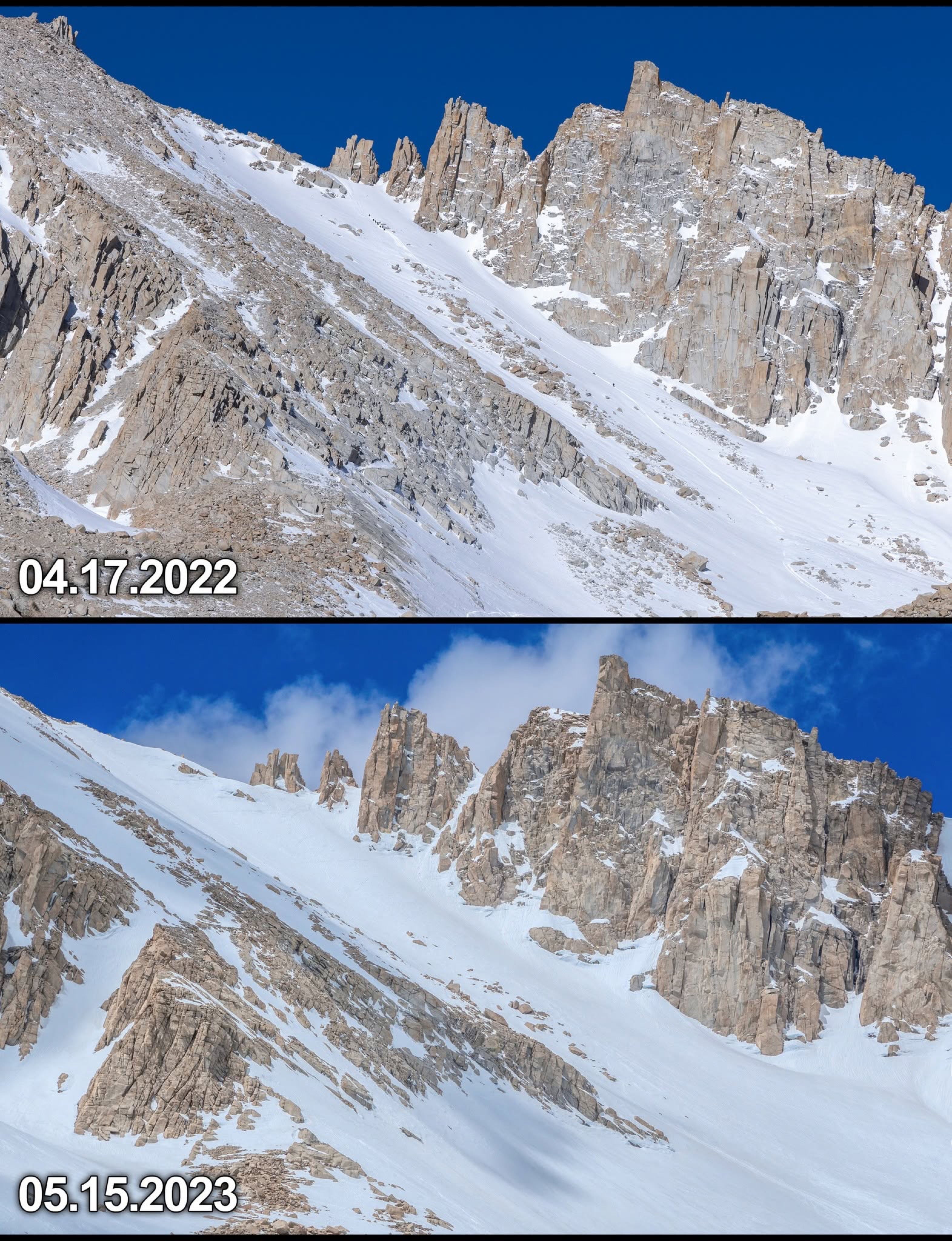
Above Trail Camp is where it will transition from normal hiking to classic mountaineering. The normal route (99 Switchbacks) will very likely be snowed in still; snowed in and in the process of actively melting out, which will make them a dangerous rockfall zone. The safest (and most fun) route will then be up the slope to climber’s right of those switchbacks. To ascend this slope, you will need crampons (preferably on a stiff-soled boot), an ice axe and a helmet. (a helmet because it’s also a rockfall zone, though a safer one than the 99 Switchbacks under these conditions, and because it presents a fall hazard, with rockbands in your fall-line). There have been LFCSAFTD incidents in this area as well, not to mention countless injuries, all avoidable and all due to the same mechanism of failure; improper route finding, bad timing, bad decisions and incorrect gear and/or skillset for the terrain and prevailing conditions.
The section between Trail Camp and TrailCrest is the crux of the Main Trail in Winter or Spring shoulder season conditions. It must be timed and managed properly for success. If you're unsure how to time or manage it properly, ask the group. Answers to that question are easy to answer and might actually save your life. The section is short (about 8% of the entire route), but lots of (completely avoidable) drama has played out here…
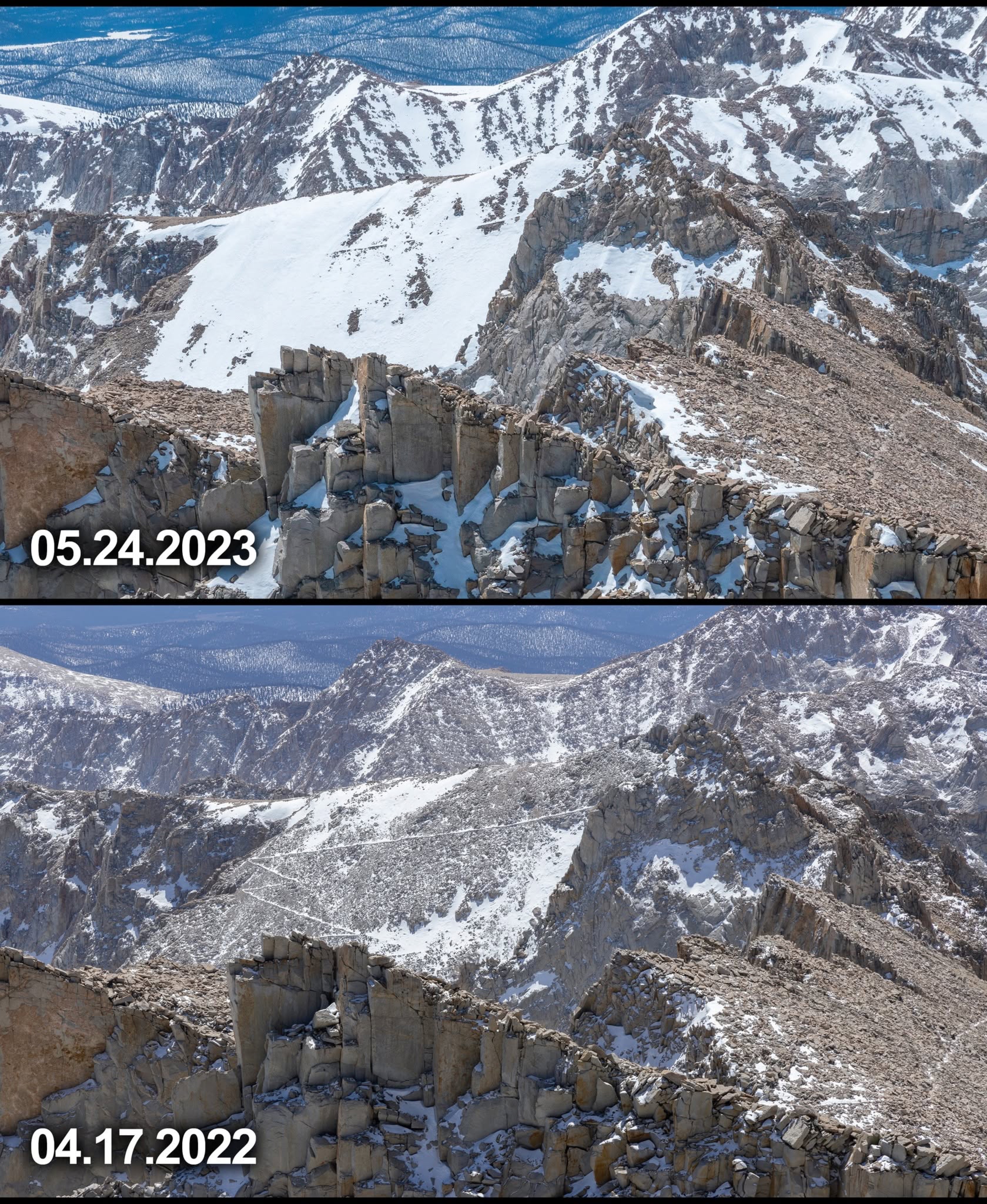
Above this 1200 vertical feet, mostly 30° snow slope is Trail Crest. Between Trail Crest and the summit, on the West Slope, it will be partially-to-mostly dirt-trail conditions, (which you’ll want to do in just boots) with some sections of snow you’ll have to cross. While the trail itself is flat here, the sections you need to cross will be steep, angled snow slopes terminating in rock bands (also known as “consequence multipliers”…). You’ll need to make sound decisions about putting crampons back on (and taking them off and putting them back on...) based on how severe and frequent these crossings are. Self-arrests in this type of terrain are difficult; solid footing is what keeps you safe in terrain and conditions like this. “Solid footing” on steep snow slopes usually means “crampons”.
There’s sometimes lingering snow on the slope up to the summit plateau, and sometimes this snow can be very firm névé; ice-adjacent. It usually poses no issue though, other than the fact that people are pretty frequently wasted by the time they get here, suffering from some mixture of hypoxia, hypoglycemia, dehydration, ataxia, AMS, and sometimes hypothermia. (also all avoidable...)
The last big terrain section you’ll need to mitigate is the descent from Trail Crest to Trail Camp; down what you came up. If you’ve timed your day incorrectly and this slope has begun to refreeze (it begins to refreeze around 15:30 in mid-May), you might need to face-in down-climb it. If you move fast and efficiently and arrive when this snow slope is still soft (1-2pm), you can plunge-step down it, and maybe glissade some of it. You’ll likely be pretty tired by this point, which is also a consequence multiplier. Keep your head on…
Once back to Trail Camp, you'll just walk out the rest of the trail, basking in your success.
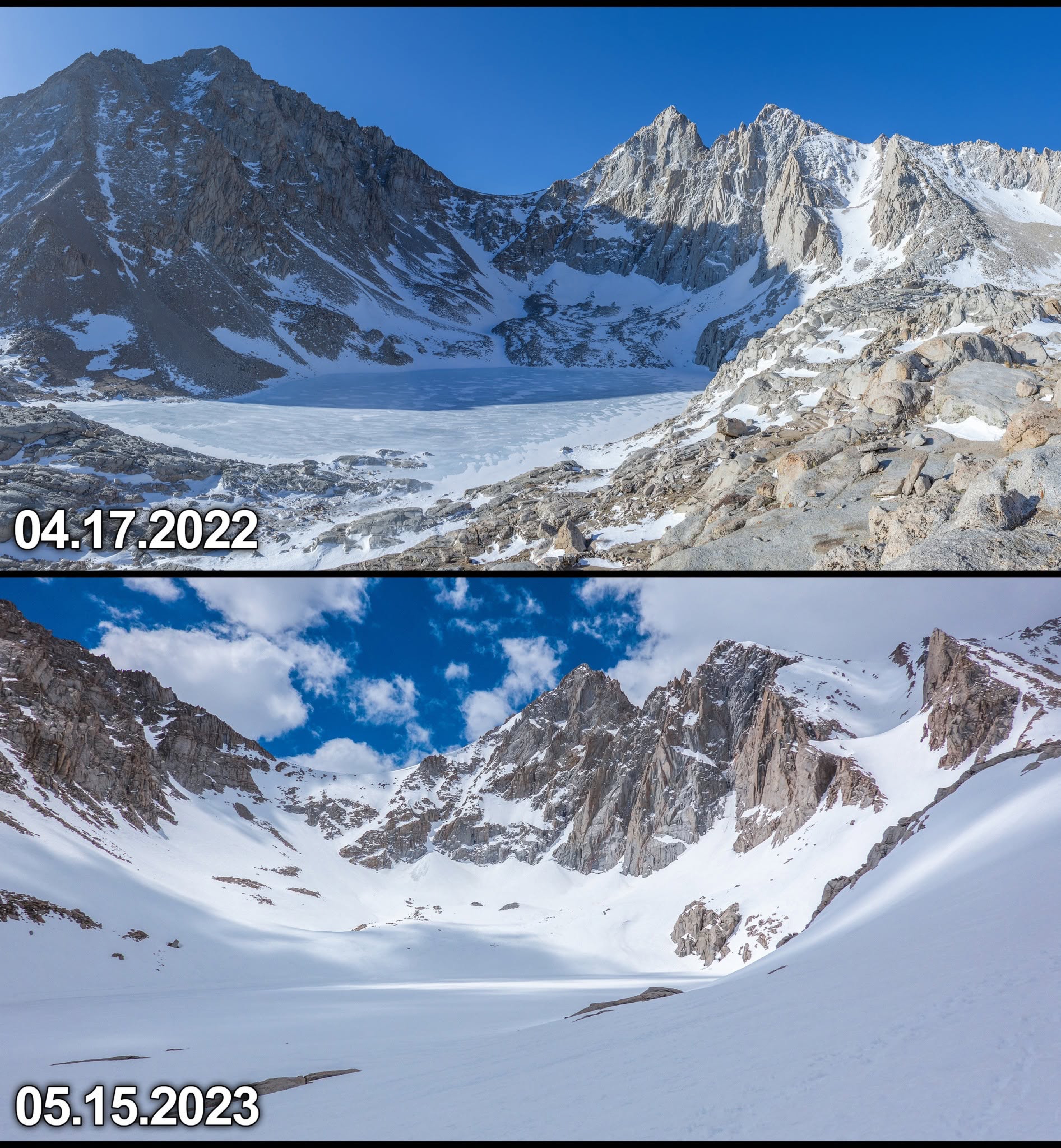
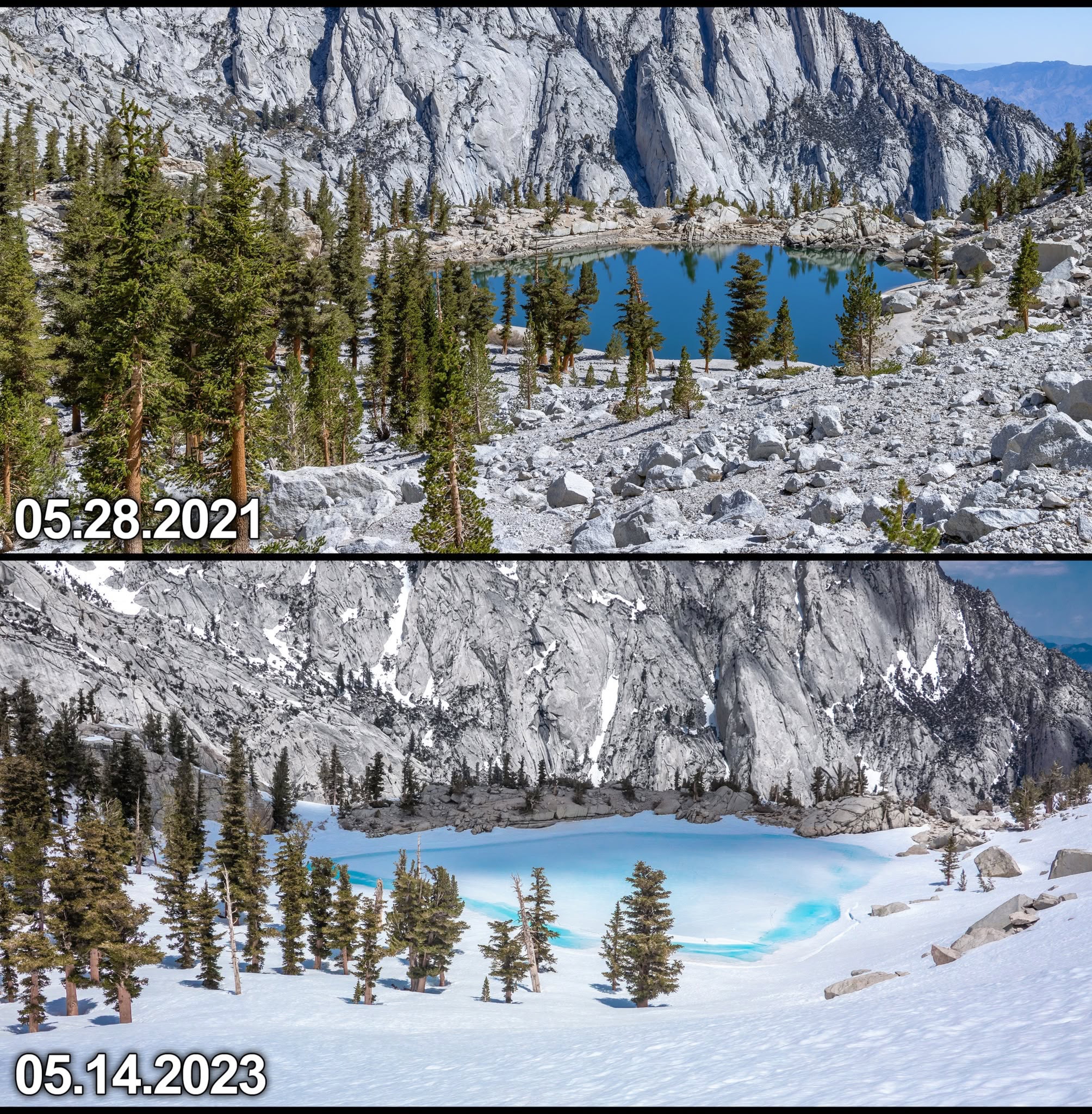
Attached are some photos I’ve shot in May or June on (or of) the Main Trail over the years (some late April ones in there, too). I've posted the comparisons before, but it's helpful to see them again as a reminder. I've labeled them with the dates and locations. Every year is of course different. Some years gave us very high seasonal snow totals, some very low. This year is average.
Have fun and make good decisions.
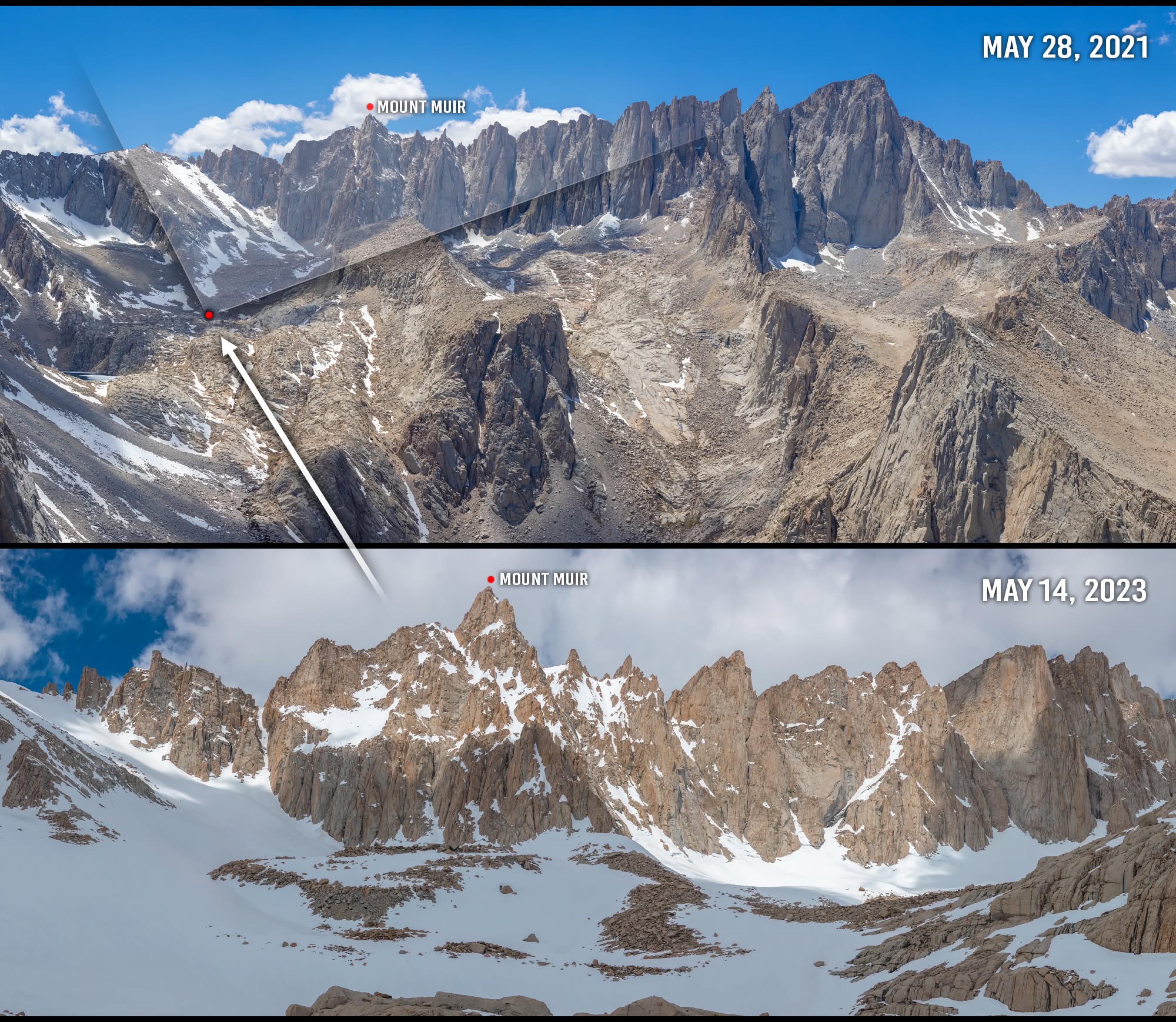
The 2020/2021 seasonal snowpack was significantly below normal for the Southern Sierra; in the 50% range.
2022/2023 was in the 200% range.
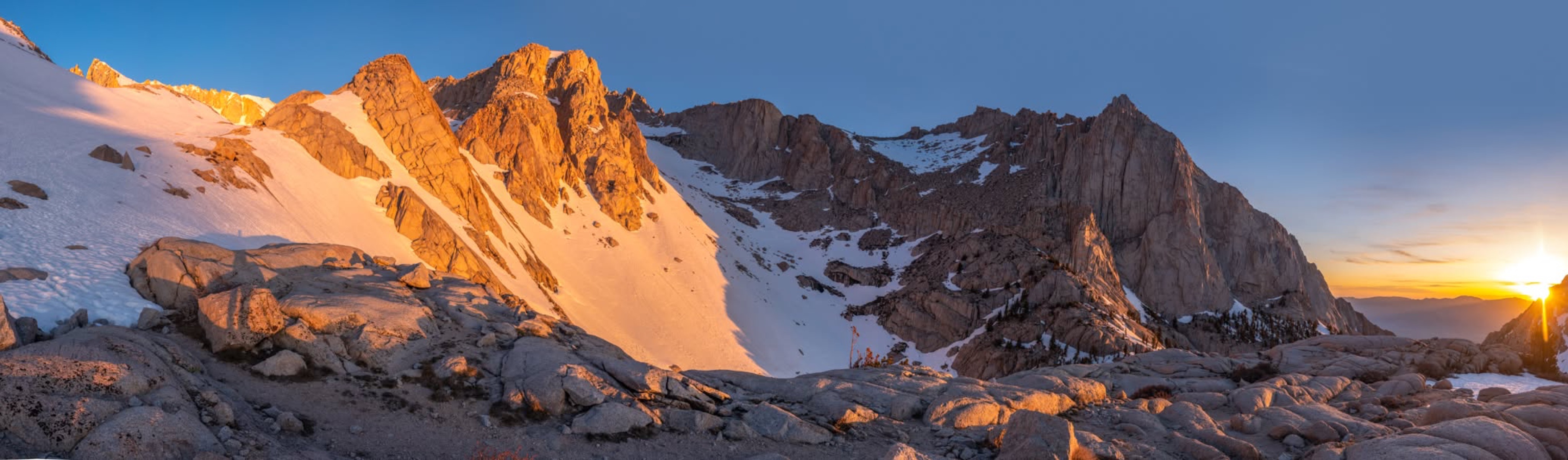
This is where you break out of the treeline. In Spring shoulder season conditions, it's hiking terrain below you, classic mountaineering above you.